Thursday, October 18, 2007

Finally a Trips Comparison!

Finally someone points out something I've been thinking for a long time about the hits on the Seattle light rail plan. The anti-transit faction has gotten away with their comparison of all regional trips to a specific corridor(s). This means they are comparing trips you take to get ice cream at 2am to trips taken on the freeway at rush hour. Obviously those 2am trips don't cause congestion, and capacity isn't an issue either. But as Diamajin points out, Mr. Westneat at the Seattle Times gets it too:

Project A, the no-brainer, will carry an additional 110,000 people daily over its 30 miles by the year 2030, according to its planners.

Project B, the wasteful one, will carry an additional 180,000 people per day over its 50 miles by the year 2030.

So ... the boondoggle will transport more people? For the same construction cost?

So it goes in the upside-down world of our transportation debate, circa 2007.

Project A is the widening of the Eastside's Interstate 405. The plan is to spend $10.9 billion (in 2002 dollars) laying four new freeway lanes and a bus rapid-transit route.

When done, the road will be 67 percent wider and carry 110,000 more trips than now. In some parts it will flow more freely. In others — such as the evening rush hour between Bellevue and Renton — it will be as jammed as it is today. (All this is from the state's studies.)

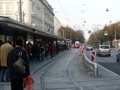
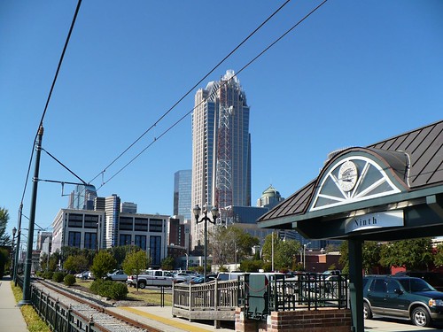
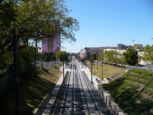
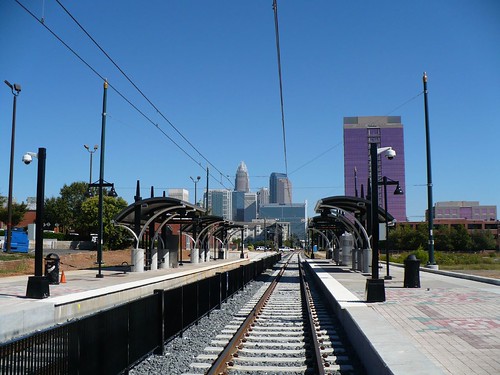
Project B is Sound Transit's light-rail plan. For $10.2 billion (in 2006 dollars), it would extend rail north to Lynnwood, east to Bellevue and south to Tacoma. The whole system, including the line being built now, is projected to carry 300,000 riders daily by 2030.

So the Times does some stuff right with Mr. Westneat, but allows Mr. Niles to parrot one of the anti-transit factions favorite comparisons without proper analysis of his claim. Regional trips to a specific corridor. As has been said before, the Big Dig only takes less than 2% of regional passenger miles. And before the cost escalations the road warriors loved that project. Some still love it and hope to repeat it in Atlanta among other places. But, as we know from the previous comparison: 180,000 > 110,000. But is it just 180,000?

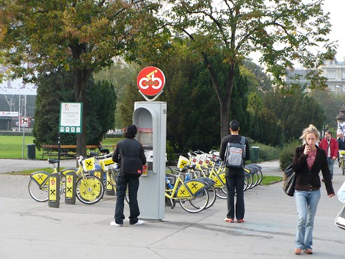
What I would like to see is these 311,000 transit trips plus the calculation of walking trips generated from smarter development, specifically the trips that won't be taken by car. This is what the folks in Portland are referring to as the trip not taken.

In a 1994 travel survey, it was shown that areas with good transit and mixed use development got 9.8 VMT per capita. In outlying areas of the city, that number went up to 21.7 per capita. So if we look at the 7,200 housing units that were built in the vicinity of the streetcar, this means an annual reduction of 31 million VMT! This suggests that people don't have to drive as far (good for carbon reduction) and take trips using other means such as bikes and walking (even better).

So it seems to me that in this instance, if this light rail and streetcar network in Seattle generates smarter growth patterns for the next 1 million people, you can count on significant VMT reduction and more alternative trips. Now compare that to adding another freeway which will just add more VMT due to the extra trips you need to take in a auto-centric environment. I wish someone would discuss these issues rather than taking the bait and talking about that dumb region to corridor comparison.

All Rails in Space City

This afternoon the Metro board finally approved rail on Richmond putting the best line forward they could even if it wasn't the best line (Thanks Afton Oaks!). In a shocker that I don't think anyone expected, they also voted for light rail on all 5 lines! But after reading Christof's blog I was wondering if what he said about funding and the FTA was true? I haven't noticed any change in the funding mechanisms so what is going on down there? Is it possible that because Tom Delay is gone they have better support from their legislators (sans "I don't like rail" Culbertson)?

This was made possible by the other surprise of the day — the Southeast Line on Scott, along with all the other 2012 lines, will be light rail, thanks to new FTA funding rules. Thus, the Southeast Line and University Line will be able to share track on Scott. And that amended idea carried.
Perhaps they have been behind the scenes like Salt Lake City working out a deal with the feds to pay for their lines in bulk since they have a master plan. I think that might be the wave of the future so other cities might want to look close at how to plan a system then get funding for it rather than going line by line. We'll probably hear about it more in the coming days. From the Chronicle:

"We now feel we can pass federal muster (to obtain 50 percent funding) by going to light rail on all five lines at once," board chairman David Wolff said. "We can't help but believe that people will be thrilled by it."

In 2005, residents and elected officials along the planned North, East End, Southeast and Uptown lines were dismayed to learn that Metro analysis showed cost and ridership on them would be too low to justify federal funding for rail.

Check out the link to Christof for a new system map.

The Integration of Transit & Land Use

There is a Salon article that discusses how real this video is. Amazing!

Wednesday, October 17, 2007

Pay Now or Pay Later

That's what the Seattle PI is saying. And you know what, they are right. Costs and materials are always going to escalate and unless you get started its always going to cost more.

Speaking of the future ...It is coming, regardless of how you vote for this proposition. You could vote no and leave us in the transportation "Groundhog's Day" situation we're in. Or you could vote yes -- and we implore you to -- and free this region from its gridlocked thinking.

Tuesday, October 16, 2007

Really Freakin Fast

So if you go to Budapest watch out for the killer escalators. They are faster than any others I've ever seen. My mom almost ate it a number of times getting on. They are so fast they get videos on YouTube. AND they have bike races on them!

Monday, October 15, 2007

Utah Nimby's Have a Good Thing

Some just don't get it. They could have the best situation in the world but they wouldn't know it. Transit in Utah has the story.

Sunday, October 14, 2007

Vienna's Ringstrasse

In addition to the ring system in Budapest, Vienna has the Ringstrasse. Interestingly enough, there isn’t a single line that completes the loop however many lines come into town and turn around next to the loop leaving the downtown walking city to be accessed only by the Metro system. There are several lines which use the Ringstrasse but all lines link to specific metro stations on the Ringstrasse with the Strassenbahn (Tram) filling in the accessibility gaps between Metro stations and regional rail. The central city is completely walkable, mostly cobbled and in some instances closed off to cars.

Vienna_TramLoop18

What is the history of this tram ring that allows the circulation of this signature street? Initially the ring was the city fortifications. However Franz Joseph, the King of the Austrio-Hungarian Empire decided that it wasn’t needed anymore and wanted to create a signature street. And create a meaningful place he did. The street is very wide and accommodates automobiles, streetcars, as well as a wide tree lined pedestrian and bike space.

The most interesting piece related to transit is not really the loop itself, although its an important part of both Vienna and Budapest transport, but rather the multimodal connections that are made at certain nodes along the Ringstrasse. At one node, there are four tram stops on the surface, a tram turnaround just beneath the surface and a connection to the M2 Metro which follows its own ring around half of the downtown. In the photos below you can kind of see how this works.

Vienna_TramLoop6

Vienna_TramLoop7

Vienna_TramLoop9

Vienna_TramLoop

Vienna_Bikeshare

In another node, there are loops for trams, buses and the Metro connected by tunnels which allow citizens to not cross the Ringstrasse on the surface. Underneath the surface its like a mini-mall with eateries and the infamous Tabak shops where you can buy cigarettes and your metro pass.

So why do these systems work? Well first off they are the circulators for all modal connections with in the central city. Their operation is dependent on the interface of faster Metro lines and slower tram and bus connections (the photo below is a tram and bus stop). In Vienna specifically the buses sometimes are even using the tram right of way and stops of the trams. They also all connect to the intercity trains on the edges of town allowing anyone living in town to get around effortlessly without a car.

Vienna_TramROW10


This means that its incredible affordable to live in the old parts of Vienna. I was told that inside the ring is expensive, but just outside of the ring you can get a nice flat for $600 per month. I will warn folks that there are lots of good restaurants there so food could get expensive.

And if you're worried about the environment, there are people there to remind you.

Vienna_Karntnerstrasse_C02x

Charlotte Sans Train

I went out on Friday and took some pictures along Charlotte's light rail line. In the neighborhoods along the line, there are many signs in windows displaying "Vote no" on the repeal of the transit tax.

P1000967

P1000950

P1000957

P1000953

P1000963

P1000959

I was however annoyed with the waste of space for the electric substation, basically taking up a prime parcel of property close to the tracks for one use that could have been integrated into a larger development. They might be able to salvage it, but it seems unlikely that they will try. The substation is the brick box in the center of the property below(cut off a bit by blogger). Notice how the other development builds to the line.

P1000980

Wednesday, October 10, 2007

Flying Drone & Obama's Enviro Tone

I can't seem to stay put in San Francisco. I feel like the airplane is my second home and my body doesn't know what time it is. Right now I'm in Charlotte so hopefully I'll be able to get some light rail pictures for folks, or at least some good TOD pictures. So I won't be getting to the Ringstrasse today.

There is some news that i'd like to share even if I can't cover it as adequately as i'd like. Obama let loose on his plan to take on climate change. Hill Heat covers it pretty well but here is my favorite part...

Sustainable communities
  • Reform federal transportation funding to take into account smart growth considerations
  • Require states to plan for energy conservation for the expenditure of federal transportation funds
  • Reform the tax code to make benefits for driving and public transit or ridesharing equal
Carless in Seattle also has some of the scoop. I dunno what anyone else thinks, but this seems like a big deal. Here is some of the policy speech he gave.

Tuesday, October 9, 2007

Streetcars & Philanthropists

Michael Cudahy, a Milwaukie philanthropist, is sick of the leadership there not getting along on transit issues. So what does he do? He proposes his own streetcar line and suggests that developers pay for parts of it. If only developers paid for all of them, then we'd be in business.