
Monday, April 19, 2010
Perhaps a New Game
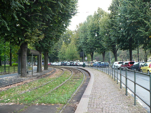
It's called, spot the wires. Sure are ruining this nature scene for everyone! This is Turin, Italy.
Thursday, April 15, 2010
Bigger Thinking on Texas Stadium Site
In my post below I talked about how hard it would be to connect the two parcels over the freeway. Looks like they have thought about that.
 In an article in Fast Company, the developers and city of Irving are looking to make the freeway choked property where the stadium once was into "the densest, most walkable neighborhood in the Dallas-Ft. Worth Metroplex outside of downtown Dallas." That's a pretty bold statement. But the renderings show they have some ideas about how its gonna be, and I must say, they do have a grand imagination.
 Via the Irving Chamber
If they can get this done more power to them. I especially appreciate them doing it on the transit line. Now how about that transit connectivity? This type of density needs more than just one rail line.
In an article in Fast Company, the developers and city of Irving are looking to make the freeway choked property where the stadium once was into "the densest, most walkable neighborhood in the Dallas-Ft. Worth Metroplex outside of downtown Dallas." That's a pretty bold statement. But the renderings show they have some ideas about how its gonna be, and I must say, they do have a grand imagination.Via the Irving ChamberIf they can get this done more power to them. I especially appreciate them doing it on the transit line. Now how about that transit connectivity? This type of density needs more than just one rail line.
Wednesday Night Notes
Notes for folks:
China is seeking their own manifest destiny with trains. (Reuters)
~~~
China's Urban property is going up in price. (Wall Street Journal)
~~~
A new (to me) place to get all of your transport research needs!
~~~
The most hilarious (unintended of course) trucks vs. trains conspiracy theory I've ever read. I probably shouldn't link to it, but I couldn't resist. (Examiner)
~~~
The Pedestrianist discusses what should happen to San Francisco's Central Freeway.
~~~
Why people underestimate the pain of their commute. (Frontal Cortex)
~~~
Why the Expo Line goes where it goes... (via @thetransitfan)
Sunday, April 11, 2010
How Things Should Work
Unfortunately it was raining pretty hard today, which means I can't get NBC and apparently AT&T service is somewhat haywire. But the Master's was on TV and there was a commercial that showed how AT&T wishes people could buy train tickets. While its nice to think that it would or could even work in this way, it will take upgrades to wireless in the subways and faster connections speeds. I wonder if they could have done this on a freeway.
Stadium Implosions and TOD
Well today was the day. 39 year old Texas Stadium was imploded as its functioning life was deemed over. However the death of a stadium opens up new opportunities for urbanism and some challenges.
The Loop 12 station is going to be located here when the development is finally ready for it but I question the planning of a station along a freeway or in a place where the freeway can severely hamper residential development. Part of the problem with getting cozy with the highway is that you cut off half of the walk shed from the station. In this instance, it's even more than half with the number of freeways that exist in criss cross. Below is the map of the regional transit plan and below that is the station location sourced from the environmental impact statement.


You can see Texas stadium where the main redevelopment opportunity is on city owned land. But the planned station is on the other side of a major freeway, and most of it is a private shipping company under the white blob I've drawn to show the area without a freeway barrier near the station. It's likely that this area will be best for office and some dense residential, but a grid network needs to be reintroduced on both sides for it to become a walkable urban place. It might be even better to route the transit through the center of the white blob to maximize the station area. It does move the station further away from the stadium parcel, but at the same time, it increases the probability of transit accessibility for buildings within the vicinity of the station.
It's a hard decision, but ultimately we need to stop building stations and alignments that are based on the previous freeway paradigm. Creating walkable urban places that connect to others through transit means that we need to connect opportunities, not freeway medians.
The Loop 12 station is going to be located here when the development is finally ready for it but I question the planning of a station along a freeway or in a place where the freeway can severely hamper residential development. Part of the problem with getting cozy with the highway is that you cut off half of the walk shed from the station. In this instance, it's even more than half with the number of freeways that exist in criss cross. Below is the map of the regional transit plan and below that is the station location sourced from the environmental impact statement.

You can see Texas stadium where the main redevelopment opportunity is on city owned land. But the planned station is on the other side of a major freeway, and most of it is a private shipping company under the white blob I've drawn to show the area without a freeway barrier near the station. It's likely that this area will be best for office and some dense residential, but a grid network needs to be reintroduced on both sides for it to become a walkable urban place. It might be even better to route the transit through the center of the white blob to maximize the station area. It does move the station further away from the stadium parcel, but at the same time, it increases the probability of transit accessibility for buildings within the vicinity of the station.
It's a hard decision, but ultimately we need to stop building stations and alignments that are based on the previous freeway paradigm. Creating walkable urban places that connect to others through transit means that we need to connect opportunities, not freeway medians.
Friday, April 9, 2010
Thursday Night Notes
Here's some news I wanted to share:
I did a report on aerial ropeways once. The City Fix shows they are used for transport around the world and even in their favorite place, South America.
~~~
The Cotton Belt rail line in Dallas might have an interesting funding mechanism.
~~~
DFLers are going to start playing hardball with U of Minn. I don't really see how a mitigated train is any different than a few thousand cars and huge buses on the same road.
~~~
Are we really going to be spending $3.7 billion or more for a subway stop in Livermore and (an overestimated) 34,300 riders? Have we learned nothing from any of the other transit lines we've built (or didn't build) in this region? If Pleasanton has 7,400 exits (14,800) on a weekday, how is Livermore going to add 30K more riders???
 ~~~
~~~
Baseball and Streetcars were bff back in the late 1800s.
~~~
One of my favorite things about the internet is all that it can do to break down international barriers. For example, this hungarian transport blog translated discusses the Salt Lake BRT line.
I did a report on aerial ropeways once. The City Fix shows they are used for transport around the world and even in their favorite place, South America.
~~~
The Cotton Belt rail line in Dallas might have an interesting funding mechanism.
The plan would most likely include much steeper fares for the Cotton Belt, paid parking, and the creation of special tax districts that would capture property tax increases associated with private development along the rail line.I'm always dubious of using value capture to pay for infrastructure. There's just not that much of an increment on commuter rail I think.
~~~
DFLers are going to start playing hardball with U of Minn. I don't really see how a mitigated train is any different than a few thousand cars and huge buses on the same road.
~~~
Are we really going to be spending $3.7 billion or more for a subway stop in Livermore and (an overestimated) 34,300 riders? Have we learned nothing from any of the other transit lines we've built (or didn't build) in this region? If Pleasanton has 7,400 exits (14,800) on a weekday, how is Livermore going to add 30K more riders???
 ~~~
~~~Baseball and Streetcars were bff back in the late 1800s.
~~~
One of my favorite things about the internet is all that it can do to break down international barriers. For example, this hungarian transport blog translated discusses the Salt Lake BRT line.
Tuesday, April 6, 2010
St. Louis Kinda Back in the Transit Space Race
I haven't talked about the transit space race in a while because not a lot of big news has been happening. That and I've been a bit busy lately. But tonight a huge event took place in which a half cent sales tax was passed to better bus service and build light rail extensions to other parts of the St. Louis region, building off of one of the great light rail success stories in this country.
Yonah over at Transport Politic drew a map earlier this year of what the increase could help build over a 30 year period, though some of it is a bit wishful thinking because while $75 million a year is a lot of money, it's not the same as say Measure R's $40B in Los Angeles. But what it also did is trigger a City of St. Louis tax that was approved in 1997, raising an additional quarter cent, valued by some at around $8 million per year.
I hope that they increase the bus service much more because currently the service is subpar. This infusion hopefully allows them to fix that and move forward. I'm hopeful that the anti-tax sentiment out there didn't get to this plan and transit marches forward. Even sweeter in Wendell Cox's backyard.
Markets and Urban Development
I've been meaning to weigh in on the debate (1, 2, 3 and others) from a while ago on zoning restrictions that cause sprawl and the general libertarian argument. Matt, Ryan, and others have been pushing back hard on the idea that suburban sprawl is based on the market.
Basically the argument goes that because the market is not able to balance what people actually want, housing markets such as San Francisco, New York and many city centers to cost much more comparatively to places in the periphery. In addition, home owners don't want to see change. They like things the way they are and become an entrenched entity against any densification seeking to put all new growth somewhere else.
I agree with all of this but also would like to note that markets for density are highly dependent on agglomeration.
It's also based on access. Just because someone runs a light rail line to a destination doesn't mean that a market for density is going to magically appear. If we think about where suburban centers pop up, it generally has to do with the transportation network and infrastructure that was set up to support it.
Ultimately the densest places are those that grew up close to where the major employment centers are located or proximate enough to the other largest employment center in the region with access enough to feed on it. Tyson's for example feeds off of the DC metro area and is suffocating. In order to get denser, the infamous edge city has to upgrade its circulation system and throughput. The Silver Line starts to do this and plans for a better grid and streetcar system are in the works.
But sometimes landowners believe their land is worth more than it actually is which stifles density plans as well. For example, in Houston in Midtown along the Main Street Corridor, there are some land owners just holding out for super high density projects that the market can't bear quite yet.
Basically the argument goes that because the market is not able to balance what people actually want, housing markets such as San Francisco, New York and many city centers to cost much more comparatively to places in the periphery. In addition, home owners don't want to see change. They like things the way they are and become an entrenched entity against any densification seeking to put all new growth somewhere else.
I agree with all of this but also would like to note that markets for density are highly dependent on agglomeration.
If land prices are rising, as they are empirically, firms economize on land. This behavior increases density and contributes to growth.But what causes land prices to rise, or at least be high enough to support economization and higher densities? I would say that there needs to be a key catalyst, perhaps a major employer moving into an area or a major landowner or government entity focusing energies into a single place. These infrastructure investments increase land value and in turn make new dense developments possible. The demand for this type of living is real, but the ability to supply it can be harder and more locationally dependent than general sprawl.
It's also based on access. Just because someone runs a light rail line to a destination doesn't mean that a market for density is going to magically appear. If we think about where suburban centers pop up, it generally has to do with the transportation network and infrastructure that was set up to support it.
Ultimately the densest places are those that grew up close to where the major employment centers are located or proximate enough to the other largest employment center in the region with access enough to feed on it. Tyson's for example feeds off of the DC metro area and is suffocating. In order to get denser, the infamous edge city has to upgrade its circulation system and throughput. The Silver Line starts to do this and plans for a better grid and streetcar system are in the works.
But sometimes landowners believe their land is worth more than it actually is which stifles density plans as well. For example, in Houston in Midtown along the Main Street Corridor, there are some land owners just holding out for super high density projects that the market can't bear quite yet.
The typical price per square foot for land in the Midtown area grew from $4 per square foot in the early 1990s to more than $50 per square foot in 2006. This is in part due to land speculation fueled by the new light-rail line, with some buyers purchasing land in anticipation of higher land values in the future.Or burdensome regulations such as parking requirements take the possibility of building higher density out of the mix. Once you get over a certain height, steel instead of wood must be used for construction and costs increase again. But all of this isn't possible if the land values are low or if demand isn't there. Demand typically increases when existing densities exist. But for many cities or station areas, this can be tricky. We can say that there is a demand for denser living, but we also need to know where the market exists to expand the agglomerations that exist, because unlike sprawl, we can't just build into nowhere land.
Tuesday, March 23, 2010
Changing How We Think
Update: Some of this is just folks trying to kill transit projects by forcing them to restudy. But it would be nice if for the Red Line this was a serious thought at the start.
Already the new New Starts rules are starting to change thinking about transit investments. Now if we only had the money to construct these lines.
Already the new New Starts rules are starting to change thinking about transit investments. Now if we only had the money to construct these lines.
The committee wants MTA officials to take a look at “heavy rail” alignments for those proposals. Heavy rail is the mode used in the Baltimore Metro Subway, and MTA officials have insisted that it would be too expensive to win crucial federal approval.
But new Federal Transit Administration guidelines from the Obama administration have raised hopes among transit advocates that heavy rail might make more sense, because the consideration has been expanded to include more than just cost effectiveness.
War on the Car
It moves forward. It feels like I'm reading Killer Angels again...
The War on The Car drags on. The Resistance continues to suffer heavy casualties. Our foot soldiers, mounted forces, and transit brigade have launched numerous offensives this past year, but made only minor advances.
Monday, March 22, 2010
Monday Night Notes
Ah it's been a while. Got a bit of a chance today to throw you some links
Anyone wonder if the PDC could redevelop the Post Office property in a more urban fashion and then lease a single urban building back to the Postal Service with 5 blocks for more urban development?
~~~
San Jose could take back roads from Caltrans in order to do things that actually move more people. San Francisco should do this with Van Ness as well. We might have actually had BRT by now if we did...
~~~
Innovative financing mechanism in Australia for infrastructure.
David Lazarus says it's hard to get around on transit in LA. I wonder how far people go in LA versus other regions that makes transit so hard for people to consider. In Europe, new cell phone studies say people don't stray more than 6 miles (via Planetizen)from their home. I'd be interested to see what LA's sphere is like.
~~~
Aaron makes a really big point that I honestly never realized was missing in the news I consume.
CTOD releases it's TOD and GHG report.
Anyone wonder if the PDC could redevelop the Post Office property in a more urban fashion and then lease a single urban building back to the Postal Service with 5 blocks for more urban development?
~~~
San Jose could take back roads from Caltrans in order to do things that actually move more people. San Francisco should do this with Van Ness as well. We might have actually had BRT by now if we did...
~~~
Innovative financing mechanism in Australia for infrastructure.
~~~The deal will enable the government to charge developers $95,000 per hectare to fund infrastructure in new fringe suburbs instead of ordinary home buyers. And instead of paying the tax up front they will pay 30 per cent when they purchase the land and the remainder in stages as the land is subdivided.
David Lazarus says it's hard to get around on transit in LA. I wonder how far people go in LA versus other regions that makes transit so hard for people to consider. In Europe, new cell phone studies say people don't stray more than 6 miles (via Planetizen)from their home. I'd be interested to see what LA's sphere is like.
~~~
Aaron makes a really big point that I honestly never realized was missing in the news I consume.
Newspapers used to explain what national and international trends and events meant to us, to our towns. They put the major events of the day in a local context.~~~
CTOD releases it's TOD and GHG report.
Double Vision
While it's great that the Chronicle and others are calling on Houston Metro to have a regional vision with goals, it means nothing without a tandem city land use and development infrastructure strategy. While Houston has no zoning in the usual sense, it does have everything else needed to regulate development (restrictive covenants, parking requirements, setbacks etc). The region can't just keep building HOV lanes and even light rail/commuter rail lines to chase development. Chasers never prosper, but leaders do.

Sunday, March 21, 2010
Open Thread
When I don't post for a while I get emails from folks interested in chatting about anything from high speed rail to the absence of overhead wires. I feel like I should foster a greater ability to have conversations outside of topic posts. So if you have something to say or share, I'll try to have more open threads.
Wednesday, March 10, 2010
Movement Depression and the Way Forward
It's been a bit rough lately. With the economy in the tank and people not wanting to spend any money, I've had great hope that some places were continuing to move forward with their urban rail plans. But the opponents fight harder than ever because they see the threat or people don't plan things enough to go forward with any confidence. Just today, the list of articles that show how hard we have to keep working was a bit much for me to handle.
Houston - The Mayor questions whether there is money to pay for two lines of the new five line light rail expansion in the city.
Austin - The Mayor decides its not time to have a bond election to pay for a future urban rail line.
Scotland - The company building Edinburgh's tram wants to delay 30 months after the rough ride they have already had.
Tampa - Ballot issue for rail dead for now due to lack of decision in how much of the funding would go to the rail project.
Bellevue: The city council is a bunch of morons there and don't want to run the line through a dense employment center.
There is a ray of hope out there. The Mayor of Los Angeles made me feel a bit better recently when he decided that he was going to ask to get things done faster. Ask for a loan so you can save billions in construction costs and have something built for your money faster. I would like to think that is how we work in the United States. But sometimes reading all the news I do just gets so depressing. At least someone has suggested a way forward. Whether we follow it or not is up to us.
Sunday, March 7, 2010
Oscars Miss the Train Again
Every year I feel like I harp on this because I think that outside of these people with fancy gowns, there are a lot of folks including press that could get there via the subway. The first year I noticed this was the year that Al Gore won for An Inconvenient Truth. It's somewhat unfortunate that people aren't hopping on to make a statement. They might even get to the show faster.
February 27 2007 - An Inconvenient Truth
February 22 2009 - Oscars Lame Again
February 27 2007 - An Inconvenient Truth
February 22 2009 - Oscars Lame Again
Saturday, March 6, 2010
Saturday Night Notes
Opening up cities to new media.
~~~
Where there's a bad freeway, Norquist is trying to tear it down.
~~~
The tension between growth and saving industrial land is at the leading edge in Oakland.
~~~
Why the Lagos bashing asks Next?
~~~
~~~
Where there's a bad freeway, Norquist is trying to tear it down.
~~~
The tension between growth and saving industrial land is at the leading edge in Oakland.
~~~
Why the Lagos bashing asks Next?
~~~
Thursday, February 25, 2010
More Urban Form
In an attempt to go a little deeper into the previous post I went looking for more pictures of Rotterdam and Houston and found even better comparisons and interesting views than the photos I posted before.
It should also be said that I don't mean to discount the devastation of war to people and property. There is a difference between choosing to build parking lots and having your life and possessions destroyed.
First Rotterdam:
This from scientific psychic:

And this from the special collections of the Wageningen Library:

Next Houston:
Clearance of housing to build US59 via TexasFreeway.com, an amazing resource if you want to see how freeways were built in Texas.

Also via TexasFreeway.com, a view of Houston from the same angle as the previous post's shot:


This is from Aerial viewpoint. A historic shot from 1945 compared with today. Notice the freeway intrusion. Also notice the downtown getting taller. Finally, where Union Station used to be is where highway 59 rockets through on the east side of downtown and Minute Maid park now exists with a token train filled with oranges.


It should also be said that I don't mean to discount the devastation of war to people and property. There is a difference between choosing to build parking lots and having your life and possessions destroyed.
First Rotterdam:
This from scientific psychic:

And this from the special collections of the Wageningen Library:
Next Houston:
Clearance of housing to build US59 via TexasFreeway.com, an amazing resource if you want to see how freeways were built in Texas.

Also via TexasFreeway.com, a view of Houston from the same angle as the previous post's shot:


This is from Aerial viewpoint. A historic shot from 1945 compared with today. Notice the freeway intrusion. Also notice the downtown getting taller. Finally, where Union Station used to be is where highway 59 rockets through on the east side of downtown and Minute Maid park now exists with a token train filled with oranges.


Thursday, February 18, 2010
Parking Bombs
More! That's the scream of merchants and others who believe that a downtown without an endless sea of parking is not worth going to. But once the whole downtown turns into a parking lot it's not really worth much anymore is it? Yet we still see the discussion of parking dominate without an eye for the destruction that it can cause a downtown if left unfettered.
Before Portland's miraculous return as an urban Mecca, it too was once infested by parking. So was the city of Houston, where parking lots took over most of the downtown at one point.

Via Mike Lydon and Transit Miami (Via the book City Shaped)
Perhaps you can say how different this is from Rotterdam after German bombing...

It's unfortunate that we didn't see what we were doing to our wonderful cities in the name of cars first. Europe had war, yet we dismantled our cities in a similar way in the name of progress. So much parking though, what has that done to the city's value? What has it taken away in terms of tax revenue from land and greater employment agglomerations? A study by Anne Moudon and Dohn Wook Sohn showed that offices that were clustered had greater values than those that weren't in the Seattle region. In addition to the spending on highways that expanded our regions to their current far reaches, how much real estate value did we destoy?
Greater value for downtowns was lost and in the process we saw places like Hartford, as found by Dr. Norm Garrick at UConn lose population, employment, and their character. Not just the loss from parking, but from the gutting of the city by the Interstate System. Here are some slides from Dr. Garrick showing the destruction. When he toggled through the first time, the room I was in audibly gasped for air.
Hartford Pre Interstate

Hartford Post Interstate

So what's the damage? The amount of tax creating employment did not grow and parking spots skyrocketed.


So in aggregate what did this look like? The red shows it all:

Lost revenue, lost agglomeration, lost value. Will these examples teach us a lesson about too much parking? Perhaps
Before Portland's miraculous return as an urban Mecca, it too was once infested by parking. So was the city of Houston, where parking lots took over most of the downtown at one point.

Via Mike Lydon and Transit Miami (Via the book City Shaped)
Perhaps you can say how different this is from Rotterdam after German bombing...
It's unfortunate that we didn't see what we were doing to our wonderful cities in the name of cars first. Europe had war, yet we dismantled our cities in a similar way in the name of progress. So much parking though, what has that done to the city's value? What has it taken away in terms of tax revenue from land and greater employment agglomerations? A study by Anne Moudon and Dohn Wook Sohn showed that offices that were clustered had greater values than those that weren't in the Seattle region. In addition to the spending on highways that expanded our regions to their current far reaches, how much real estate value did we destoy?
Greater value for downtowns was lost and in the process we saw places like Hartford, as found by Dr. Norm Garrick at UConn lose population, employment, and their character. Not just the loss from parking, but from the gutting of the city by the Interstate System. Here are some slides from Dr. Garrick showing the destruction. When he toggled through the first time, the room I was in audibly gasped for air.
Hartford Pre Interstate

Hartford Post Interstate

So what's the damage? The amount of tax creating employment did not grow and parking spots skyrocketed.


So in aggregate what did this look like? The red shows it all:

Lost revenue, lost agglomeration, lost value. Will these examples teach us a lesson about too much parking? Perhaps
Subscribe to:
Posts (Atom)