The first of their reservations is that construction will scare away customers; and second, that faster transit will encourage bigger buildings which will spell disaster for small businesses. Reservation number one is reasonable; but number two is whaaaaa? Is your argument seriously "we need slower buses because small businesses can only survive if nobody can get to where they're going on time"?Really? That's the exact reason why I never go to the Richmond. Because it takes to freakin long to get there without a car! Seriously people, how long do we need to go in these circles before we realize that rapid transit in San Francisco would facilitate the movement of not just people, but money into merchants wallets from other neighborhoods. There are many nights when I think I might want to go to the Sunset or Richmond to get a bite to eat but I don't want to waste 2 hours on Muni. Might as well cook at home. Fast transit does not kill business, slow transit does.

Showing posts with label Urban Form. Show all posts
Showing posts with label Urban Form. Show all posts
Monday, August 10, 2009
We Don't Want Faster Transit
In a recent meeting with Merchants on Geary street, they believe that access would kill their businesses.
Tuesday, July 28, 2009
Alone in a Sea of People
I actually like to go get a bite to eat on my own and have seen a few movies on my own. A few folks I know are amazed because they could never go out by themselves. I think that if there are things you enjoy and you want to do, why not do them! If you can get friends to come, even better.
Cities are funny places. You're not quite so alone in your neighborhood when you meet all the people that live and work in the establishments around you. I know the bartenders and the bagel makers as well as the local sushi chef. That last one is a bit hard since he notices when I don't come back every week and gives me a hard time. But cities are places you can do that. I certainly couldn't do that in Austin, at least not where I was living on 38th street. But my friends lived further away there as well, so I had to drive. Here many of my friends are within a bus ride or a short walk. Makes it easier to run into them unintentionally on the street, which always feels good.
Cities are funny places. You're not quite so alone in your neighborhood when you meet all the people that live and work in the establishments around you. I know the bartenders and the bagel makers as well as the local sushi chef. That last one is a bit hard since he notices when I don't come back every week and gives me a hard time. But cities are places you can do that. I certainly couldn't do that in Austin, at least not where I was living on 38th street. But my friends lived further away there as well, so I had to drive. Here many of my friends are within a bus ride or a short walk. Makes it easier to run into them unintentionally on the street, which always feels good.
Thursday, July 23, 2009
Importance of Employment Centers
Jarrett has an interesting post on how LA is more like Paris with their polycentric form than a more monocentric place like New York City. I've been looking all week at LEHD data, mapping out job clusters and have noticed that many places in the United States are polycentric. This is also something Richard Layman talks about a lot as well, but in a slightly different way.
For example, the Twin Cities has a number of job clusters that could be made walkable if given a push. It's quite possible that this is a better way to look at transit possibilities, rather than the traditional hub and spoke. Jared makes this point, but the proof is in how our regions are laid out and how people already commute. I don't have the maps here now, but most of the major clusters in the twin cities draw residents from around that cluster. Meaning many people live closer to where they work than we might have thought, they just don't live close to the major center of the region, but rather thier own major cluster.
 This all leads up to talking about how to fill in the centers and connect those people to thier cluster. Chris Leinberger talks about Walkable Urbanism and building up centers. You can see this in DC where places have grown up around the Metro lines. In other regions, places have grown up where there are metro lines such as Atlanta, but also have grown densely but not as walkable in other places. Many of these places could be added to and reconfigured for walking.
I once thought Phoenix would be hard pressed to change its ways. But it has really good bones and a regional grid that is almost unmatched in the United States. There are also two major places outside of downtown that could be even more dense than they are today with greater access. They could already support high capacity transit, the one area north of downtown just got attached to the new light rail line.
North Central
 Camelback Road

But you also have to do it right. In my travels to Denver, I noticed that the Tech Center which has the most jobs outside of downtown has fairly lousy access to the light rail line. This place will not transform as easily as it might have with the line running straight through the center of the density existing, density you can tell was created by cars.
Denver Tech Center
 These pop up in other regions as well, and usually represent the best place to connect downtown with another major job center. These corridors also make for the best starter transit lines, especially if you're having to work with the cost effectiveness measure, because you're going to get the most riders from them. Houston knows this for certain, because in connecting Downtown to the Medical Center, they were able to build the highest passenger density new light rail line in the United states.
Medical Center and Rice University
 In Atlanta, it's Peachtree outside of Downtown on MARTA and Buckhead just a bit further north. The point I've been trying to make is that more of these places could be created and ultimately connected together in a web with better transit. But it's much easier to demonstrate in pictures than with just words.
Peachtree
 Looks kind of like Arlington no?

Buckhead Station in Atlanta
 Which kind of looks like Bethesda

The biggest thing I think we see here is how if there is a station, the density fills in between the lines. The Phoenix example is just density for cars, not people. This all can change though, and more centers could pop up around the region to foster more walkable urban development. These centers need to be connected by transit, and if connected, will follow Jarrett's ideal:
For example, the Twin Cities has a number of job clusters that could be made walkable if given a push. It's quite possible that this is a better way to look at transit possibilities, rather than the traditional hub and spoke. Jared makes this point, but the proof is in how our regions are laid out and how people already commute. I don't have the maps here now, but most of the major clusters in the twin cities draw residents from around that cluster. Meaning many people live closer to where they work than we might have thought, they just don't live close to the major center of the region, but rather thier own major cluster.
 This all leads up to talking about how to fill in the centers and connect those people to thier cluster. Chris Leinberger talks about Walkable Urbanism and building up centers. You can see this in DC where places have grown up around the Metro lines. In other regions, places have grown up where there are metro lines such as Atlanta, but also have grown densely but not as walkable in other places. Many of these places could be added to and reconfigured for walking.
I once thought Phoenix would be hard pressed to change its ways. But it has really good bones and a regional grid that is almost unmatched in the United States. There are also two major places outside of downtown that could be even more dense than they are today with greater access. They could already support high capacity transit, the one area north of downtown just got attached to the new light rail line.
North Central
 Camelback Road
But you also have to do it right. In my travels to Denver, I noticed that the Tech Center which has the most jobs outside of downtown has fairly lousy access to the light rail line. This place will not transform as easily as it might have with the line running straight through the center of the density existing, density you can tell was created by cars.
Denver Tech Center
 These pop up in other regions as well, and usually represent the best place to connect downtown with another major job center. These corridors also make for the best starter transit lines, especially if you're having to work with the cost effectiveness measure, because you're going to get the most riders from them. Houston knows this for certain, because in connecting Downtown to the Medical Center, they were able to build the highest passenger density new light rail line in the United states.
Medical Center and Rice University
 In Atlanta, it's Peachtree outside of Downtown on MARTA and Buckhead just a bit further north. The point I've been trying to make is that more of these places could be created and ultimately connected together in a web with better transit. But it's much easier to demonstrate in pictures than with just words.
Peachtree
 Looks kind of like Arlington no?
Buckhead Station in Atlanta
 Which kind of looks like Bethesda
The biggest thing I think we see here is how if there is a station, the density fills in between the lines. The Phoenix example is just density for cars, not people. This all can change though, and more centers could pop up around the region to foster more walkable urban development. These centers need to be connected by transit, and if connected, will follow Jarrett's ideal:
If you want a really balanced and efficient public transit system, nothing is better than multiple high-rise centers all around the edge, with density in the middle, because that pattern yields an intense but entirely two-way pattern of demand. If balanced and efficient transit were the main goal in Los Angeles planning, you'd focus your growth energies on Westwood, Warner Center, Burbank, Glendale and perhaps new centers in the east and south, while continuing to build density but not necessarily high rise in the middle.This way we can accommodate the complete market for housing, not just the segment that is single family, and most can have access to quality transit. We can also cut down on VMT while serving our polycentric regions with quality transit of all types.
Tuesday, June 30, 2009
When Fitness Centers are Like Catenaries
I never understood why developers waste their time building fitness centers or other extras no one really uses. I wouldn't want to pay rent for that. Seems like they might start to figure out that gold plating isn't getting them where they wanted to go. So who thinks that LRT needs to go through the same de-goldplating process?
“The frills are coming out,” said Tim Colen, executive director of the Housing Action Coalition, who advocates for housing in the city. “No concierge, no fitness room, and much smaller units. These are the coping mechanisms for the new era we’re in.”And in light rail world, the quote would look like this:
“The frills are coming out,” said Some Guy, executive director of the Rail Construction Coalition, who advocates for transit in the city. “No rebuilding curb to curb, no gigantic catenaries, and much smaller station designs. These are the coping mechanisms for the new era we’re in.”Via Curbed SF
Creative People Walking to Bowl
When do trends or catch phrases end? Does a good background idea like the Creative Class ever just go bad? What does this mean for Walkable Urbanism or Bowling Alone? Folks like Richard Florida, Chris Leinberger and Robert Putnam build up names for themselves around a central theme. The theme must be a good idea at some point, and why if it was so catching before, does something fade or not fade?
I think you have to look at the underlying facts and basic premises of it all. At the most basic level, every city has a creative class, but at what point does being a really lame city hurt you and the generation of big ideas? To me all of these folks have something in common in that they are trying to figure out why there are some places that people like to live more than others. But the boiled down answers aren't so simple as they make them out to be. Different strokes for different folks I guess.
I think you have to look at the underlying facts and basic premises of it all. At the most basic level, every city has a creative class, but at what point does being a really lame city hurt you and the generation of big ideas? To me all of these folks have something in common in that they are trying to figure out why there are some places that people like to live more than others. But the boiled down answers aren't so simple as they make them out to be. Different strokes for different folks I guess.
Wednesday, May 27, 2009
Not About Just Buildings, Cars
CNT has released another Affordability Index update that shows transportation emissions is 70% less in cities than in the suburbs. Why is this? Because people don't have to drive as much. You can see already the benefits and it isn't all about electric cars. Yet some in Southern California think that SB375, the landmark climate change bill can be addressed with electric cars alone. Sorry guys. It doesn't work like that.
Schuiling challenged the idea that land use changes are required to meet the state’s GHG reduction goals because the goal cannot be met by making cleaner vehicles, as the California Air Resources Board has suggested. “That is simply not true,” Schuiling said.But its not just transportation, it's building as well, but we need to look at this as a complete system. This singular focus on one method is somewhat maddening. I know there are a lot of people who are hoping for a magic green car or a magic green building but we're also forgetting our water usage and population growth among other things. We can't keep building lanes on our roads and we certainly can't keep growing out over all the farmland in the Central Valley or Napa. The best thing we can do is look for solutions to all these things and I feel that is compact development and transit options.
Wednesday, May 20, 2009
Trends Favor Core
Funny, that's not what the folks at Reason, most of New Geography, or Cato tell me.
Most demographic and market indicators suggest that growth and development across the country are moving away from the suburban and exurban fringe and toward center-cities and close-in suburbs.But why?
What's behind this shift? Empty-nesters don't need the big house and don't want to mow the big lawn. High gas prices are making long commutes less practical. The urban renaissance in big cities ranging from New York to Portland, Ore. — and the revival of charming, vibrant downtowns in small cities like Missoula, Mont. — is making the bedroom suburb and the strip mall seem positively dull.
Wednesday, May 13, 2009
Oh Parking
Ryan gives us this treasure trove from an industry that doesn't understand its contribution to many ills that plague good development and sustainability in this country.
Thursday, April 16, 2009
Industrial Tipping Points
Richard calls for a separate tax classification for industrial land because its too easy to change when the demand is high for other uses. It's interesting because I've been thinking a lot about the near downtown industrial districts ripe for redevelopment with streetcars and light rail. While industrial land is usually easiest for redevelopment, it can also be tricky when some or all of that land is viable for industrial uses. Areas like the Pearl in Portland, South Lake Union in Seattle, Channelside in Tampa, and the South End in Charlotte were once industrial districts that have since been redeveloped because of increased transit accessibility and proximity to downtown.
However other areas such as parts of West Oakland have been deemed off limits to developers even when the proximity to downtown is just enough that a streetcar or light rail line would explode the potential in the area. This is because the industrial land is still viable as such and city council saw value in keeping the jobs and land available in the area. I can't say that I disagree with this assessment but what is the point where industrial properties anywhere are too valuable to tax base?
For the most part, many of the easy pickings in downtowns around America have been taken back in the form of downtown adjacent former brick industrial buildings that have formed a base for a loft district fairly close to downtowns. But there are still spots waiting for a rail line that have good bones and would be great spots for the new streetcar suburbs. Is there an area in your cities that have dwindling industrial uses and is within a two mile radius of downtown?
Monday, April 13, 2009
A Different View
It's generally known that places like San Francisco, New York City, and Europe draw the ire of conservatives for their "liberal" tendencies. But do they really hate those places? Or is it a reflexive action based on the views projected from a southern base?
It would seem to me that this views of these places also translates to modes of transportation that are seen as "european" or basically foreign as well such as light rail. Which to me makes it all the more amazing that Charlotte has been able to move itself towards transit expansion that is seen as the cutting edge in cities around the south, even those that have existing systems such as Atlanta. The amazing thing there is the changing political will towards a more transit centered, urbanism. I would argue that Charlotte in particular is a function of outsiders from the Northeast. The Urbanophile has laid out why outsiders have a way of making changes to a community because they can see something different.
I remember visiting my parents from college when they lived in Rotterdam for a year and being amazed at the different transportation types, streets for people instead of just cars, and the fact that my dad could just walk to work. I was amazed and I believe it was one part of how my views changed towards the ones that I have now. Before that, I just hadn't been exposed to anything like it and didn't know it existed.
It's not that they aren't open to the experience, they just haven't had it. Not sure how that could be fixed, but it might explain some of the reasons for the San Francisco and New York bashing from the South. We're generally afraid of what we don't know. What do you all think?
It would seem to me that this views of these places also translates to modes of transportation that are seen as "european" or basically foreign as well such as light rail. Which to me makes it all the more amazing that Charlotte has been able to move itself towards transit expansion that is seen as the cutting edge in cities around the south, even those that have existing systems such as Atlanta. The amazing thing there is the changing political will towards a more transit centered, urbanism. I would argue that Charlotte in particular is a function of outsiders from the Northeast. The Urbanophile has laid out why outsiders have a way of making changes to a community because they can see something different.
Outsiders are willing to imagine things being different in the first place since they already experienced and indeed grew up in an environment that is different. It's sort of like visiting a foreign country for the first time. We notice how all sorts of little things are different, prompting four reactions. The first is, "Hey, things are different here." That can be a revelation itself. When we grow up and experience only one way of doing things, we tend to think everybody must do it that way or that there is only one way to do it.A possible function of the Southern feeling towards San Francisco or Europe is that they haven't been there before and their impressions are based on what they are told rather than what they experience. How many people do you know have changed their view of their own places after seeing a foreign country? I also have to wonder how much of the south is bigger cities as well and how much the lack of cities might lead to a similar feeling.
I remember visiting my parents from college when they lived in Rotterdam for a year and being amazed at the different transportation types, streets for people instead of just cars, and the fact that my dad could just walk to work. I was amazed and I believe it was one part of how my views changed towards the ones that I have now. Before that, I just hadn't been exposed to anything like it and didn't know it existed.
It's not that they aren't open to the experience, they just haven't had it. Not sure how that could be fixed, but it might explain some of the reasons for the San Francisco and New York bashing from the South. We're generally afraid of what we don't know. What do you all think?
Monday, April 6, 2009
Chris Leinberger Says It
I've seen a lot of these quotes recently.
Rail transit drives walkable urban places. I've never seen one dollar of real estate investment invested because of a bus stop. But if you have [rail] transit, it's a different story altogether.
Wednesday, March 18, 2009
One Dozen Per Million
Chris Leinberger has been hoofing it around the country pushing his idea of walkable urbanism and regionally significant walkable urban places*. Just today he got articles in Sacramento and Raleigh NC on his ideas. In Raleigh, they are thinking that if plans are followed through, it will be the end of sprawl. The skeptic in me says highly unlikely.
But i'm intrigued with how he came to the idea that every million people in population needs at least half a dozen regionally significant walkable urban places*
But i'm intrigued with how he came to the idea that every million people in population needs at least half a dozen regionally significant walkable urban places*
Leinberger said his study of metropolitan Washington, D.C., and Atlanta suggests that a city should have no more than a half-dozen walkable urban places per million people. Some of these will be downtown, some in inner-ring neighborhoods, and some in the suburbs, But what they have in common is their location at rail-transit stops, not on highways.
By his math, Raleigh should attempt to create two or three such places, in addition to downtown, by 2030, when the comprehensive plan anticipates the city will be home to 600,000 people.
These places should be on the rail or a streetcar corridor, which, he said, are permanent and attract investors, developers and upscale buyers. "I have never seen a dollar of real estate investment generated by a bus stop," Leinberger said.
If this is based off of DC, we need to start building a lot more monocentric rapid transit in our regions. This creates the ability to connect places that have different niches for the needs of the population. Not every walkable district is going to have everything you need, so they need to be connected with accessible transit. In Sacramento, there's more than enough room to build these significant places, but they need more transit.
According to Brookings Institution research, there should be eight to 12 regionally significant, walkable urban, transit-oriented places in the region. Today there are only three: downtown, midtown and Old Sacramento. The opportunity for locating and building five to nine additional walkable urban, transit-oriented places and building far more development in the existing three would be worth billions of dollars and would represent a more sustainable way of living.*I wish he would define this more precisely.
Saturday, March 14, 2009
Never the Freeway Median
I think we've discussed this before but we need to really stop building transit lines on freeways. I'm not talking about allowing buses to use the HOV lanes but rather building new light and heavy rail lines along the side or in the center of freeways. If we want to create the most value out of these investments, existing ROW needs to be thoroughly examined for its benefits, which includes existing freight ROW as well.
The South Corridor in Charlotte is a good example of using the existing ROW because it runs a close parallel to the main south arterial street. However lines such as the Baltimore light rail line are really poor applications of existing ROW. The line there completely misses the downtown of Towson which is a major regional destination. BART is a huge example of rail transit designed for the auto age. Why didn't they run the Pittsburgh BayPoint Line under Broadway in Oakland instead of along the freeway median to Rockridge?
I think we need to think about how we can move away from focusing solely on the Interstate system that is built out as well as believing that since the interstates are there, they are the best routes for transit. They are the worst routes for Urbanism as freeways are not urban.
Wednesday, March 4, 2009
Sea Change?
Is the economy leading to a change in land use? Eh. I'd like for it to happen, but the allocation of more money for highways in the stimulus bill leads us in a different direction that I'd like to think we're going. The major evidence will come in a few years after the transportation bill is finalized and money starts moving to projects other than roads. Perhaps we will see that acceleration they're talking about then.
By the way, if you want to see where Interstate bridges are going to crash in your congressional district, DOT has maps.
By the way, if you want to see where Interstate bridges are going to crash in your congressional district, DOT has maps.
Saturday, February 28, 2009
Does This Look Familiar?
I believe it looks like the creation of sprawl. If you wanted this to happen, why are you in the city at all? Why not just move to the exurbs. It already exists like that there. It's another example of the car companies and traffic engineers fantasy that everyone wants a car and everyone can have a car if we just pave the city with lanes to accommodate it. It's just cleverly repackaged as a promo for GPS navigation. Fortunately, we're beginning to think differently about the roll they play.
Tuesday, February 17, 2009
In Case You Missed Them...
Two articles were bouncing around more than others today. Politico has an article about how HSR got into the stimulus bill and David Brooks talks about a really poorly defined pew poll on urban preferences for living. What if I don't want to live next to a McDonald's or Starbucks?
Friday, February 6, 2009
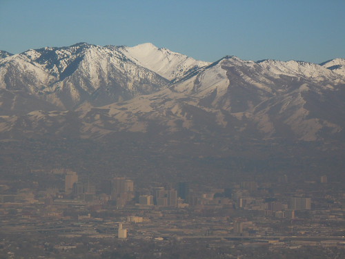
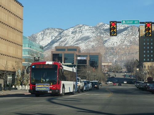
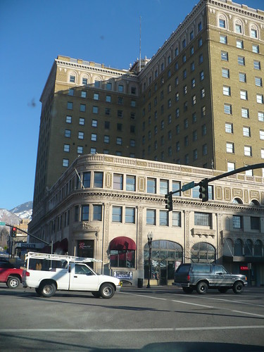
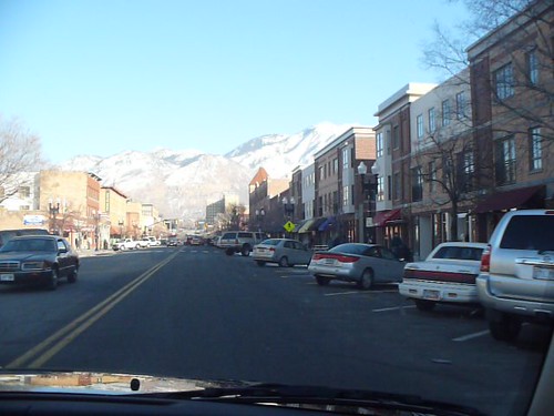
Ogden, Utah Photos
I spent a few days talking about streetcars with some folks in Ogden, Utah. Fortunately or unfortunately I didn't have access to the internet the last few days because of my schedule, but I did take a few movies and pictures. I wish I would have had a little more time for a vlog but perhaps if I go back. Also, if I do disappear for a few days, you can check me out on twitter as well. I still have to figure out how to use it more effectively but for the most part its random observations when riding transit or where i'm located.
Anyway, Ogden is a really neat little city and they have a spectacular downtown with some great old buildings and the nearby streetcar suburbs . It was the center of much of the railroad's east west movements. Much to my surprise, this wasn't Salt Lake City's role. I got to see the Front Runner Commuter line from a far and took some pictures of the old downtown. I'll have some more cool stuff up tomorrow or Sunday.
And if you wonder why we should keep moving towards better land use and transit that lowers emissions...take a look at what Temperature inversions do to Salt Lake City. They just became a non-attainment area.
This is 25th Street, really cool main street which used to be a really seedy part of town. Tons of cities would kill for buildings like these.
Front Runner Commuter Rail
Monday, January 19, 2009
Signs in the Concrete
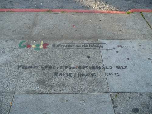
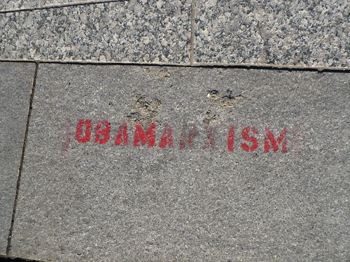
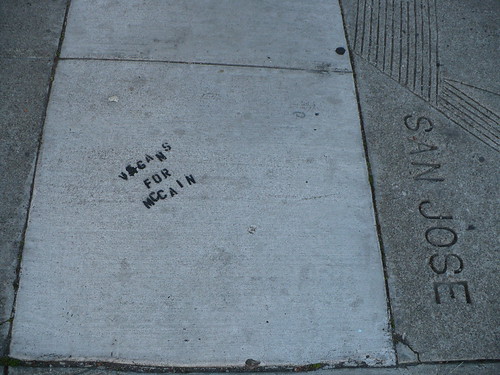
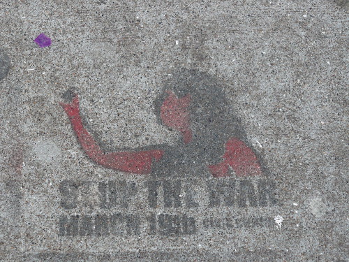
I went for a bit of a walk today in my neighborhood. Here are some of the signs I found. Not so much transit, but planning related. The most interesting one to me is the anti-google sign. I've seen them a number of times, and have heard complaints, not to mention seen how expensive housing has become in the neighborhood in even the three years I've been here. In any event here are some photos:
Water Department Cover

The Google Bus Stop. At the place where Google kids hop on the bus, someone painted this into the concrete. It says "Trendy Google Professionals Help Raise Housing Costs".
Obamaism
Vegans for McCain
Stop the War, March 19th
Mr. Seahorse Knows That No One Is Illegal

There were also some interesting signs and murals:
Good Fricken Chicken

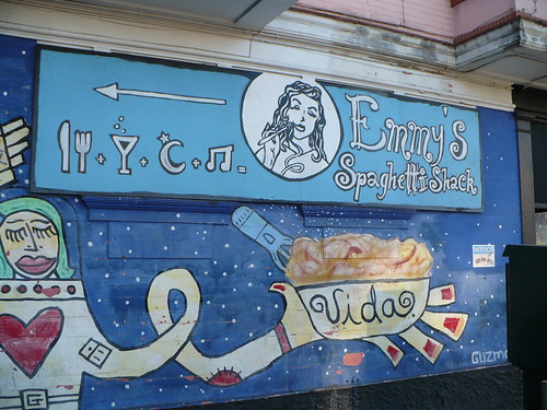
Emmy's Spaghetti Shack. Get the Spaghetti and Meatballs...mmm
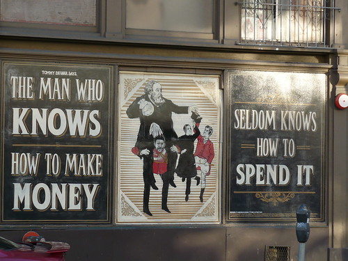
Dewar's Ad
I'll post more interesting things I found later, but I thought the signs and stencils were funny.
Water Department Cover
The Google Bus Stop. At the place where Google kids hop on the bus, someone painted this into the concrete. It says "Trendy Google Professionals Help Raise Housing Costs".
Obamaism
Vegans for McCain
Stop the War, March 19th
Mr. Seahorse Knows That No One Is Illegal
There were also some interesting signs and murals:
Good Fricken Chicken
Emmy's Spaghetti Shack. Get the Spaghetti and Meatballs...mmm
Dewar's Ad
I'll post more interesting things I found later, but I thought the signs and stencils were funny.
Tuesday, December 9, 2008
Buildings of Yore
I don't know why but there's something just plainly attractive to me about these buildings in Louisville. After seeing them, and the lego buildings over at Greater Greater Washington, it made me wonder why its so hard to build like this anymore. I mean if you can do it with legos... Granted the lego buildings are a little bit over the top, but who could complain about density that looks so clean as that strip in Louisville.
Speaking of Louisville, its an interesting case. It's not a city I hear much about but Broken Sidewalk has brought it to life. The only other contact I've come in with Louisville was when I was looking over thier long range transit plan a few months ago. They have a robust plan, but thats all it is. A plan on a shelf. In fact, they must have taken out the maps that show the transit corridors because I can't find them now. "Waiting until funding is available." Here is another place that needs a bit of a push. If offered funding for a complete system through a better federal match, perhaps that would get the wheels rolling. Some places need a bigger push than others.
Speaking of Louisville, its an interesting case. It's not a city I hear much about but Broken Sidewalk has brought it to life. The only other contact I've come in with Louisville was when I was looking over thier long range transit plan a few months ago. They have a robust plan, but thats all it is. A plan on a shelf. In fact, they must have taken out the maps that show the transit corridors because I can't find them now. "Waiting until funding is available." Here is another place that needs a bit of a push. If offered funding for a complete system through a better federal match, perhaps that would get the wheels rolling. Some places need a bigger push than others.
Sunday, December 7, 2008
Subscribe to:
Posts (Atom)