
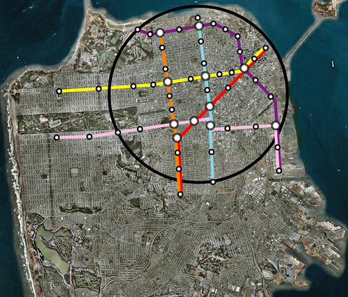
For San Francisco, Eric and others have looked at what a city wide metro would look like. However I thought it would be good to look at it from the standpoint of the sphere I created for the Oakland Map. These aerials are the same dimensions as the Oakland map as are the 5 mile spheres. In the fine grid of San Francisco, you can see that a metro as envisioned below would create a tic tac toe board where getting from destinations all over the densest parts of the city would be fairly easy.
For San Jose though I took a different approach. Instead of using downtown as the center, like Oakland, I thought about how a metro could be used to reconfigure the city and employment districts of Silicon Valley. What came out of it was a more northern sphere centered around west of the airport where there is a lot of land and buildings that could be rebuilt now that their 20-30 year life might be almost over.
It was hard to not try and cover everything instead of focusing on the sphere. These city sphere metro projects could be pretty inexpensive when compared to their resulting benefit which is why its important to think about the area in much smaller terms and corridors.
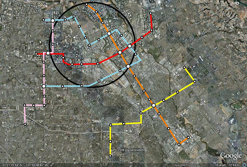
In San Jose in particular, it grew up in such a spread out pattern, that serving the area, unlike Oakland and San Francisco, would be even more daunting. But its possible to use this metro as a starting point to comprehensive feeder bus and commuter rail system that connects the major cities.
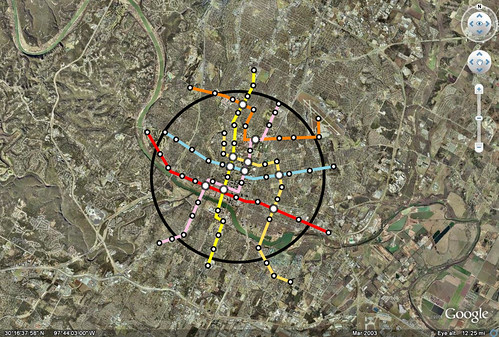
Below is an example of this exercise at build out in Austin at the same scale.
So the point of this exercise isn't to say that these networks should be built with these specific lines, but to show transit density in a core area that would promote the usage of transit in the core while also starting to change the development paradigm. If this type of service were available, walkable neighborhoods would be constructed that have more opportunities to go carless. These networks could also be used as a basis for bike planning.
1 comment:
Hey, that yellow line needs to run down South Lamar! Screw S. Congress. :)
Post a Comment