Showing posts with label Transit Networks. Show all posts

Sunday, November 9, 2008

People of the Green Book

Audio Wire Logo


The audio above is Andres Duany at this last weeks CNU Transportation Networks Summit. Now I don't agree with everything Andres says. A lot of times he drives me nuts when it comes to transit modes like streetcars because he'll go into a city and say something completely crazy like limiting streetcar distance or density before transit which are things I haven't agreed with. But in this instance he makes a lot of sense.

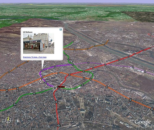
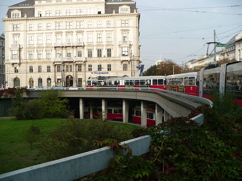
I often wonder if we're over engineering our light rail and streetcar lines as to render them so expensive that the BRT folks swoop in and say cheaper is better. The first lines we built in this country were on shoestring budgets with off the shelf vehicles and know how from folks that operated streetcars that were discontinued. As we get further away from that knowledge base, we continue to gold plate systems using super heavy catenary that is aesthetically displeasing and have been perhaps over lawyer-ed. But the technology remains basically the same, just as the automobile and we've lost a lot of that knowledge.

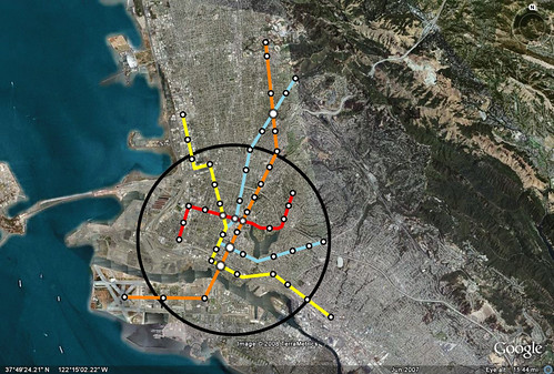
What Andres talks about in losing knowledge of how to build roads is seen in our cities where cars go too fast and road diets are often the new buzz word. What the engineer knows comes from the engineering manuals. Yet there is years of knowledge out there and best examples in our cities and existing rail lines that we can learn from. The clip is about 4 minutes. I cut out the part I thought was interesting from the 30 minute talk. So enjoy. I hope to do more of these audio things now that I have a recorder.

Saturday, September 27, 2008

Streetcar Networks

There are some regions which are building light rail, and some which are building light rail and streetcar networks. We see in the space race that the leaders are starting to look even further into the transit spectrum with multiple modes.

The most recent entrant? Salt Lake City
Fresh from a Northwest transit tour of Portland, Seattle and Vancouver with 28 city and business officials, Mayor Ralph Becker says a new streetcar network, beginning in downtown, is a priority for his freshman administration.
This is in addition to plans for Seattle, Minneapolis, Portland, Washington D.C., Ann Arbor, and a study starting soon in Fort Worth.

Sunday, September 14, 2008

Possible Streetcar Network Funding Idea

As cities look to build streetcars, its easy to come up with an initial amount from businesses but its that last few million that seems to be troublesome. A lot of cities look to TIF funding, but that source of funding has limits and many want to use it for different purposes including affordable housing and basic infrastructure such as water/gas lines and sidewalks.

So here I'm about to toss out another crazy idea that I'll need help from my economist friends to see if it is really possible to do. I'll use the Minneapolis streetcar network plan as an example. We know there is not enough funding to do it all at once. If we use Detroit's recent fundraising success from local businesses as seed money, one corridor exists to fuel the others. The fueling is in real estate transfer taxes off of the increase in value that is created by the new streetcar line. Since infrastructure such as the streetcar has been seen to add value, it's only fair that some of that value be reinvested in other areas that will receive similar infrastructure. So bear with me here as I go through the process.

1. Do an initial study to figure out the streetcar network. Once completed this will serve as the base funding area for engineering. A basic TIFF district for the whole in town streetcar network would serve as a base for the rest of the plan. The district boundaries will stay because they will be used later.

2. The Detroit instance shows that businesses and foundations are interested in their cities future. They have raised 75% of an initial $100 million in Capital Costs for a new line down Woodward. The first line should try to pull in money from outside entities and use that line to feed the others.

3. Before the first line is constructed though, a baseline is set on real estate costs in the area defined by the very small increment TIF district that was initially used for the engineering studies. This baseline would be used to calculate a real estate transfer tax that allows the streetcar network to capture the value of rising real estate values along the line. There should also be a transportation fee for new square footage. I believe that San Francisco for a long time had a fee that went to Muni at 5$ for every new square foot in a building. These linkage fees could be tied to parking reductions so its not as much of a burden on the developer, and leaves money for other endeavours such as affordable housing.

4. After completion of the first line using funding raised locally, the rising coffers funded by the transfer tax and linkage fees from the first investment go into the construction of the second line in the district. Once the second line is complete, the real estate around that line goes to the third line and so on starting off a chain of funding that creates the network. Over a 20 year period, I believe it would be possible to build each line.

I also think that if a plan like this was created, it would create more incentive for the federal government to help out if this were tied to a national strategy. So there is the idea. Funding one line at a time by fueling one line at a time as a primer for the next one.

Minneapolis Planned Streetcar Network

Sunday, August 17, 2008

A National Expansion Strategy

Since the FTA and the federal government are always looking at ways to judge projects based on how they fit into a national strategy, it might be good to think about funding transit in this way. Not because we want to be forced into the frame of the FTA, but rather it might get more interest and importance if it ties into a national strategy. Much like the 1950 federal defense highway system, this could be the national defense transit network.

The idea is that if you hop on a plane and go to Columbus, you can get to the major destinations within Columbus and then hop on a train to Pittsburgh or Cleveland and get around in those places without a car. It seems to me that if you made it easy for people from outside of the city to operate without a car, it would make it easier to operate inside of the city.

There are two components, good metro networks and good city high/moderate speed networks. The larger network should connect cities together that are larger but probably don't get as good of airplane service and major cities that generate a lot of short flight trips. The smaller networks should connect, as said before, the major destinations in a region. For example, Denver's transit network is connecting the Federal Center, the Tech Center, Downtown, and Boulder together with transit. To me, making all of these connections should make it easier for creating transit villages where people can walk or bike for many of their trips and make intercity travel easier as well.


Monday, August 4, 2008

The Option of Urbanism

On the plane I had a chance to read The Option of Urbanism by Chris Leinberger who is a visiting fellow at Brookings and a professor at Michigan. The book basically covers the changing demographics and wants of the part of the market that doesn't want sprawl anymore. I suggest the read. I'm going to pull out some quotes as well. Thought they would create some good reactions here.
The promise of the Futurama Exhibit helped launch an interlocking system of policies ans subsidies that unwittingly pushed aside all historical precedents in city building and produced the car-only, drivable suburban pattern of growth. It is the land use equivalent of the supposed Henry Ford dictate that the buyer can have a Model T "in any color, so long as it's black."
I'm going to be posting quotes from the book one by one over the next few days. Enjoy.

Thursday, July 31, 2008

Subsidy and Busolotics

Slate has a great article up on auto subsidies we don't talk about a lot...like tax deductions.

Also, Streetsblog LA has a link to the latest BRU screed. I know Damien is trying to give equal time, but these guys had an excellent chance to prove their point with the consent decree and got little new ridership from it. BRU, go away.
While the special master has ordered a one-third increase in the size of the bus fleet, “the actual number of people we carry on the bus has remained flat,” said MTA CEO Roger Snoble. (The BRU says bus ridership has increased about 1 percent per year.) “We’re not taking cars off the street. In fact, we’re adding buses to the streets, which is causing more traffic jams,” said Snoble. Since it costs about $200,000 per year to operate a bus, and most buses are only about 30 percent full, something isn’t working. Unconcerned, and despite $1 billion spent to comply with the consent decree, the BRU continues to push for even more bus purchases, doubling the size of the fleet to 4,000 buses, and a ban on all rail construction.

Monday, July 7, 2008

Fantasy Map Fever!

Why do I love fantasy transit network maps? Because unlike bus and automobile, it inspires people to think big and imagine. I think we could use some imagination these days. I've always believed it was good for you.

Charlotte

This map was created in 2005 and sent by reader J. I thought it was a really cool way to show an eventual network that benefits the whole city.

Sound Transit Maps via Orphan Road.

The Most Recent stuff from Transbay Blog.

Cincinnati maps you can buy on a shirt!

Brian G. adds Atlanta.

Anyone have any others?

Sunday, July 6, 2008

Been Thinking About Transit Density Part 2

So as a continuation of this post on transit density, we're going to look at San Francisco and San Jose. This is not transit density in the usual sense of passengers per route mile as discussed by Mr. Setty at PublicTransit.us but rather station density as discussed by Richard Layman and his oft looked at take on Belmont.

For San Francisco, Eric and others have looked at what a city wide metro would look like. However I thought it would be good to look at it from the standpoint of the sphere I created for the Oakland Map. These aerials are the same dimensions as the Oakland map as are the 5 mile spheres. In the fine grid of San Francisco, you can see that a metro as envisioned below would create a tic tac toe board where getting from destinations all over the densest parts of the city would be fairly easy.

San-Francisco-Sphere

For San Jose though I took a different approach. Instead of using downtown as the center, like Oakland, I thought about how a metro could be used to reconfigure the city and employment districts of Silicon Valley. What came out of it was a more northern sphere centered around west of the airport where there is a lot of land and buildings that could be rebuilt now that their 20-30 year life might be almost over.

It was hard to not try and cover everything instead of focusing on the sphere. These city sphere metro projects could be pretty inexpensive when compared to their resulting benefit which is why its important to think about the area in much smaller terms and corridors.

San-Jose-Sphere

In San Jose in particular, it grew up in such a spread out pattern, that serving the area, unlike Oakland and San Francisco, would be even more daunting. But its possible to use this metro as a starting point to comprehensive feeder bus and commuter rail system that connects the major cities.

Below is an example of this exercise at build out in Austin at the same scale.

Austin---Sphere

So the point of this exercise isn't to say that these networks should be built with these specific lines, but to show transit density in a core area that would promote the usage of transit in the core while also starting to change the development paradigm. If this type of service were available, walkable neighborhoods would be constructed that have more opportunities to go carless. These networks could also be used as a basis for bike planning.

Wednesday, July 2, 2008

Been Thinking About Transit Density Part 1

Richard has been pushing Belmont for a while now so tonight I broke down and bought the book.

Some thoughts before I read it though based on what I've read in Richard's posts and my own evolution in thinking.

I had a bit of a thought today that should have come together sooner but I was looking over Google Earth at a way to connect commuter rail/HSR directly to downtown San Jose instead of the current just outside of downtown location of Diridon station. It seems to me that what is needed in each city around the bay is a local metro that moves people quickly around the central city. Each of these metros can be connected by commuter rail lines like Caltrain along commuter corridors but the most beneficial systems will be those that serve future density, not just existing transit.

I started writing this post before going to Washington with the hope that on the plane I could make some maps. The good part is that the trip reaffirmed what I wanted to back up. That an in town metro is important to vibrancy and movement in a city. Serving the suburbs should be done, but the way we are going to make our transit systems work is with good circulation in the center to build up core density. If we could see where Washington DC was before Metro and where it is now, you would see a huge difference in the city. If the current naysayers were around then to kill projects, that project would have never been built, and the city would look very different.

But other cities should look to the future in the same way. The future benefits outweigh current costs and with more people preferring to live a city life, its got an increased benefit of soaking up growth that would usually cause gross distortions in where people live and work. This is the option of urbanism like Chris Leinberger says.

So we'll start at Oakland. Previously I made a fantasy map for an Oakland Metro that you see directly below.

OaklandSubway

This was based on getting people in and out of a city, and not really a core urban strategy. I realize that now, but when you compare it some of the Subway systems that work really well it doesn't really look quite right.

Vienna's Metro looks different. There are a number of lines that criss cross a number of ways. The same with the Washington Metro.

Vienna

With that being said, here's a more core system. I've come up with these for San Francisco, Oakland and San Jose as the major regional centers but am thinking about doing other cities as well. The Space Race focuses so much on suburban serving transit that the core again is left out. But perhaps this is the way we should rethink it. We'll start with Oakland.

Oakland-Sphere-2

Now all of these maps will be at the same scale for the Bay Area. The circles are about 5 miles across and show a primary core that could densify in corridors and the core soaking up a lot of housing need and with less energy usage from density, walkable neighborhoods, and easier access to close districts.

Now I'm not sure that this necessarily needs to be a Metro Subway. It could be a dedicated lane streetcar or light rail. However a subway can go from end to end without having to stop at a light and stay on schedule with faster speeds. This facilitates use. But it might work in a smaller city with a smaller sphere than the five miles for core circulation. We should think about these implications and ask, what will get us the most riders and most future benefit instead of just thinking about cost and as I've mentioned before just bringing people into the center of the city.

Saturday, June 21, 2008

Metrobama

There's chattering on the Metropolitan Policy of Barack Obama. He gave a speech to the US Conference of Mayors and here's what people are saying. I think the best part is a person in the cabinet who would be in charge of metropolitan policy. That's something we really need, considering HUD and DOT don't really talk to each other when they should.

Ezra Klein -
It's worth noting that Obama's promise to fill the coffers of the Federal Highway Fund comes before his promise to build a "a world-class transit system." He does, however, say, "I don’t want to see the fastest train in the world built halfway around the world in Shanghai, I want to see it built right here in the United States of America." I'd sort of like to see that too, so Gobama!
Yglesias -
To seize the possibility of this moment, we need to promote strong cities as the backbone of regional growth. And yet, Washington remains trapped in an earlier era, wedded to an outdated “urban” agenda that focuses exclusively on the problems in our cities, and ignores our growing metro areas; an agenda that confuses anti-poverty policy with a metropolitan strategy, and ends up hurting both.

This is a point that urban policy people have been trying to push into the mainstream for a while. The fact that Obama's saying this means, among other things, that his team is paying attention to the right people. But we have poor people who don't live in cities, and cities are facing issues besides poverty -- among other things, we have the question of how to make it affordable for non-rich people to live in nice urban areas. Other highlights:

Here's obviously this is my favorite part:
It’s time to stop spending $10 billion a month in Iraq and start investing that money in Phoenix, Nashville, Seattle, and metro areas across this country. Let’s invest that money in a world-class transit system. Let’s re-commit federal dollars to strengthen mass transit and reform our tax code to give folks a reason to take the bus instead of driving to work – because investing in mass transit helps make metro areas more livable and can help our regional economies grow.

And while we’re at it, we’ll partner with our mayors to invest in green energy technology and ensure that your buses and buildings are energy efficient. And we’ll also invest in our ports, roads, and high-speed rails – because I don’t want to see the fastest train in the world built halfway around the world in Shanghai, I want to see it built right here in the United States of America.
As many of you know I don't think Maglev is really worth it. You can go almost as fast with HSR which is proven technology. But I like the fighting spirit.

Thursday, June 5, 2008

Not that Simple

Update: You Can Listen to the Episode of Forum by clicking here.

I worry about analysis like these in the Tyee. While it's nice to think that if we didn't build that heavy rail line we could build x more miles of streetcar lines, it's really not that simple. Mostly because they serve two different purposes. You can't just say we can have 8 miles of streetcar for a mile of heavy rail, because what is happening is your trading short trips at a slower speed for longer trips at a faster speed. It's necessary to have both.

This morning I was listening to forum on KQED and one of the callers said it was absurd that he couldn't get from Sunnyvale to Berkeley in 2 hours. This is due to the lack of express trains between major destinations. In a better transit system, you would have Caltrain bullets stopping only at places like San Jose, Palo Alto, and San Francisco. Then it would go in it's own tube to Oakland and Berkeley. This is an expensive service due to the tube and electrification etc, and would likely generate calls to spend money more "cost effectively". They would say, why not build 400 buses or the next big trade off. The problem is you need both. In order to make transit useful, there need to be short trips and long trips made easy.

Now I know there is limited funding, but we need to start thinking like non-transit wonks think. And they think, why can't I get from a to b in under an hour if it takes that long in my car. Transit has to be competitive time wise, whether you're trying to hop a few blocks to get a bite to eat or going to a different city in the region.

Tuesday, April 29, 2008

Road Networks Grow Like Leaves

Very cool article posted by Christian Peralta at Planetizen. The article discusses how road networks grow organically like leaves with major arterials connected to smaller collector routes.

The researchers developed a simple mathematical model that can recreate the characteristic leaf-like patterns that develop, growing a road network from scratch as it would in reality.

The main influence on the simulated network as it grows is the need to efficiently connect new areas to the existing road network – a process they call "local optimisation". They say the road patterns in cities evolve thanks to similar local efforts, as people try to connect houses, businesses and other infrastructures to existing roads.


This is important for transit. The reason being that roads have evolved over hundreds of years often one street at a time. But we always get hammered when one transit line doesn't cure all of the region's ills. The reason being that we're providing core arterial service and depend on the smaller connections to be made by foot, bike, and car. In cities such as New York where the transit system starts to mimic the road network do we see how transit can help everyone with affordability, mobility, and energy independence. I wish folks would realize you have to start small, and grow to a network.

Sunday, April 13, 2008

Extortion in Virginia

This is rich. Apparently Norfolk State University signed a deal a few years ago that would allow light rail to run through campus. A few years later new leadership has moved into the presidents mansion on campus and apparently doesn't like the idea. Instead of going with the original agreement, the University is resorting to extortion.

Norfolk State University wants the city to purchase its president’s home and build a parking deck near campus. The requests are part of a wish list submitted to the city in a letter dated March 26. They are some of the most expensive ideas offered by NSU to resolve an impasse with the city and Hampton Roads Transit over the light rail line under construction next to the campus. No price tags are available for the university’s proposals. However, city officials said the items are not in the project’s $232.1 million budget.

But good for the Mayor, he's not buying it.
Norfolk Mayor Paul Fraim said he wouldn’t support the request under any circumstances. “I don’t think we could use public dollars for that purpose,” he said.
It seems recently that there have been a lot of anti-transit campus sentiment. The purple line in Maryland comes to mind, worried about vibrations through campus from light rail and most recently the dumbfounding move by the University of Minnesota who didn't get their tunnel through campus due to our favorite cost effectiveness measure. Now they want a rerouting that would kill the line's federal funding. Something tells me that these folks know nothing about the benefits of a line through campus for students. All over the country there are college campuses that thrive on transit connections. Unfortunately these situations above will have to be forced.

Thursday, April 10, 2008

The Affordability Index is Online

The affordability index is a different way to look at housing affordability. Since housing has been going down the tubes lately, its not surprising that the crises is hitting the suburbs of major metropolitan areas the hardest. Why? Because they are out in the middle of nowhere and its getting expensive to move around by car alone. Well folks are now starting to measure the housing + transportation costs of families and individuals showing that true affordability isn't a cheap home in the suburbs, but rather the sum of these two costs.

Take a look at the costs of different neighborhoods. In a transit rich neighborhood with all housing being equal, your cost of would be 41%. But if you had to drive everywhere, your costs would be 57%. That's quite a lot of savings by living near transit. See for yourself if you live in a transit rich or auto dependent neighborhood.

H/T Carless in Seattle.

Tuesday, April 8, 2008

Thoughts on Transit and New Urbanism

I am a member of the CNU. I've been going to congresses over the last 4 years but have noticed that a lot of other members don't really get transit or that transit should be an integral part of NU. In a session last weekend about value capture strategies, Scott Polikov showed some diagrams of communities he helped code south of San Antonio and in Leander at the end of Capital Metro's commuter rail line. While they were nice and could probably promote more walking internal of the neighborhood, he showed boutique retail and limited transit access and circulation for both projects. G.B. Arrington, former transit and TOD planner at Tri-Met in Portland who heads Parsons Brinkerhoff's place making division, raised his hand and asked a very pointed question.

"Isn't this just walkable sprawl?"

And therein lies the problem. Much of what the new urbanism is known for is their walkable sprawl which includes the Kentlands and Seaside as the projects most representative of New Urbanism from an outsiders perspective. At the end of the day all of the jobs are somewhere else and without alternative connections to those jobs and a location on the far reaches of a region, the same VMT and overall degradation of the environment will continue.

New Urbanism in principle says the right things in the Charter, but right now we're mostly neglecting the transit and mobility. This includes the understanding of bikes. I heard that Liz Moule of Moule Polyzoides who designed the Del Mar TOD stated that its silly to have showers at every place of employment to support cycling. This angered some of my colleagues who want to make the trip between neighborhoods and work accessible by bike.

If we aren't able to build places by reducing VMT, then whats the point? Building good looking internally walkable places is nice but really at the end of the day there is a reason for building it if you have to drive to get anywhere outside of the community? Without metrics or final purpose, we don't know what we're doing. Some like Andres Duany say that its all about providing happiness. But in reality there are many people out there who are happy with their freeways and huge gas guzzling SUVs.

Jan Gehl, who was responsible for bike and pedestrian renaissances in Melbourne and Copenhagen has a simple metric that destroys any argument against his improvements. Pedestrian counts. In fact he rebuked some store owners who said that they were slowly fading due to reduced auto access. He was able to prove that they were getting much increased pedestrian activity in front of the store by before and after counts.

So if we are going to build transit and build communities that reduce the autocentricity that begets sprawl, then we need to measure the effects. Else we are no better than other ideologues that state their ideas are right, without proof to back it up. I believe that we need to measure New Urbanism to make sure its working, and by working I mean reducing VMT because if we can't do that, its just walkable sprawl.

Thursday, April 3, 2008

Tuesday, March 11, 2008

Parking Lot Congestion Pricing?

I was reading up on the Seattle congestion pricing debate over at Seattle Transit Blog and Orphan Road and was thinking about ways to address the equity issue of congestion pricing. I'm wondering what kind of tax isn't regressive. Is it the land tax? Perhaps.

But what about a rush hour parking tax?

Parking garages have meters that do timestamping, so why not charge a fee for parking between 8:00 and 9:30 and leaving between 4:30 and 6:00. When you use that funding for expanding transit, you can then expand to road based congestion pricing after expanding transit. That way if you don't have any other options, you can still get in and park if its early or late making people vary their timing surely making it more equitable. I'm sure there are drawbacks because this just popped into my head and I didn't think it through completely but I'd like to hear people's take on it. It could be too limited to workers downtown for instance. Or people could just write it off on their taxes unless that benefit was taken away.

"Auckland, One of the Most Auto Dependent Cities in the World"

So these videos have been going a bit viral lately, but I haven't seen them all in one place except on YouTube. So here they are, Peter Newman and Todd Littman on Aukland New Zealand doing their best opposite day impression of Wendell C and Randall O. I posted part three a few days ago, but here they are together.

Part 1. City of Cars


Part 2. It's Too Spread Out for Transit


Part 3. Sustainable Transport is Uneconomic

Monday, March 10, 2008

U.S. Transit Takes 10.3 Billion Trips in 2007

I'd like to say that this is impressive, but it's not. If we are going to get something done in this country we can't be happy just going to the Olympics, we should want to win the gold. I will say that light rail again led the way for ridership increases at 6% but we need more.

For comparison to the much touted 10 Billion number that we've had the last two years consider this, Budapest (my favorite transit city) residents took over 1.4 Billion trips in 2003 in a region of 2.4 million people. The population of the United States is around 300 Million. While there are obvious differences in urban form and the availability of transit there versus here, its telling of what is possible if we design transport systems correctly and design our neighborhoods accordingly.

For a better western example that wasn't over run by communism until 1989, Vienna (A metro of 2.2 million) takes 700 Million annual trips. The tram network carries 280,000 passengers a day. The U Bahn metro carried 427 million trips in 2005. They began building their metro system in the 60s and finished in 1982. While they had a legacy street railways network, that can be done in time as well.

It's possible for us to catch up, but we gotta start moving a little faster. If each of the top 50 metro regions can get 700 million trips per year, we can increase ridership to 35 Billion trips. Is that possible? I don't know, I'm just tossing out numbers, but it would be amazing and would do a lot for the environment and create jobs.

I also love a good reason to use pictures from my trip last fall. The one below is a tram loop on the Ringstrasse in Vienna.

Vienna_TramLoop6

Friday, February 22, 2008

A Sad Trend in Boston

All around the country cities are trying to add light rail lines, yet some cities have the infrastructure and are failing to see the value. The Arborway is no different. In one of the first posts on this blog I discussed why buses sucked compared to reinstating the streetcar when tracks already existed. Seems like we lost the battle, but not the war. Switchback has more.