Showing posts with label TOD. Show all posts

Monday, June 23, 2008

Employment, Residential Booming Near Transit

Very cool news out of New Jersey. The state created a tax credit program for businesses that located and built near transit and its been stimulating the market. From the New York Times:
The state’s new Urban Transit Hub tax-credit program, which took effect in January for sites near mass-transit stations, is already stimulating the market, real estate specialists say, even though it applies in only nine cities.

Mr. Pozycki said the tax credit program is a crucial reason why SJP decided to move forward with its third corporate center building in Hoboken, which had sat on the drawing boards for nearly four years. (During that time, SJP shifted its focus to the hot Manhattan office market, and has begun construction of 11 Times Square, a glass-and-steel tower at Eighth Avenue and 42nd Street.)
It's great because its predicated on locating near transit so even if these offices move out of Manhattan, people can still get to work on transit, and it opens up less invested areas for dense employment development.

On the opposite side of the country, Salt Lake City is seeing more building permits for dense housing near transit. From the Salt Lake City Tribune:
Industry insiders say surging gasoline prices, a sagging economy and energy-policy uncertainty due to the presidential chase have combined to create the latest condo spurt. And it's no coincidence the new league of lofts are located near TRAX light-rail lines.
...
TRAX spine gets lofty: Open-plan lofts and energy-efficient condos are sprouting along the TRAX spine on the fringe of downtown. There is the funky Angelina's Corner on the curve of 700 South and 200 West and ultra-green Rowhaus just north of the baseball park on West Temple, and there are hundreds of units planned at Market Station, a walkable development slated for the warehouse district in South Salt Lake.

Sunday, June 22, 2008

Arlington Did It Right

One of the things that bothers me these days is the need for the FTA to judge things based on cost and not long term benefit. An article in the Washington Post discusses the long term benefits that the planners in Arlington VA saw when they decided to run the Orange line underground and away from the freeway.

It got me thinking, what would BART look like if they had made the decision to build like Metro in DC and run the line through main corridors instead of down the center of the freeway. Here is what I came up with. The dotted lines and black dots I drew and the regular line and existing stations are shown by the little BART symbols.

If I were to speculate that these stations would have the ridership of 24th and 16th street mission, we would be seeing an additional 110,000 riders.

Re-Imagining-Broadway

Since BART didn't learn anything from Arlington either, the BART to San Jose line will make the same mistakes, running on existing ROW instead of down the main corridors where its needed. The same exists with the BART to Livermore extension which we discussed earlier.

Saturday, June 21, 2008

Transportation Corridors

This is what you get when you have a long term plan for developing a corridor and do it right. I was watching some baseball today and the game was in Boston. They showed an aerial photo of the Back Bay and it got me thinking...corridors.

Arlington County Virginia


Wilshire Blvd: Flickr by ATIS 547


Boston Back Bay on the Green Line


Peachtree Street in Atlanta


I know there are more. Anyone have a corridor to share?

Monday, June 16, 2008

Two Types of Impact: Planning and Development on the Rails

While China seeks to sprawl and pursue what they think is the American Dream, the other world population giant India is looking to Japan for its thoughts on urbanization. This is a good sign for those who worry that energy will only get worse if China and India continue down the path of consumption.
Indo-Japan working group on urban development identified many areas including GIS based utility mapping, disaster management, emerging technologies in water and sanitation and clean development mechanism for further cooperation in the day long session today.

The group also agreed to explore on capacity building in urban transport, rail-based transit system, comprehensive mobility planning and management using intelligent transport systems.
Back in the United States, Phoenix is seeing a market shift around its soon to be open light rail line. In fact $6 Billion dollars has been spent on development along the line and now that gas prices are higher, land has become even more expensive and coveted.
Light rail is not the sole reason why projects in the transit system's vicinity have developed, real-estate analysts note. But the future system has definitely been a catalyst prompting developers to pay higher prices for property adjacent to the line for condominiums, office buildings and retail centers. Economic factors, including soaring fuel prices, have caused developers like Eugene Marchese to focus attention on transit-oriented projects.
I expect to see more of these stories about the direct benefits of investing in transit as well as these on the more high profile blogs. Maybe the pols would do well by starting to pay attention.

Tuesday, June 10, 2008

Why It's Not a Priority

I've been meaning to write about Ryan's article in Grist for a bit now, but have only gotten around to it now. Many of you have probably already read it but in case you didn't, check it out. Many kudos to him for putting his thumb on the problem.

He discusses why such a big issue doesn't get a lot of attention and no big plan has come to the forefront to address it. Part of the problem is Journalists afraid to tackle the subject.
And as part of the broader political conversation, transit lingers in relative obscurity. My informal polling of several environmental journalists in Washington suggested that discomfort with available information on transit and emissions reduced their willingness to write on the subject. As such, transit struggles to join the political conversation -- and since it's not part of the conversation, writers have little incentive to learn about it. On the cycle goes.
I'm going to chalk that up to the fact that they don't get it. I give Ben Wear of the Austin American Statesman a hard time on here because it's obvious he doesn't know a trolley pole from his .... but also the conversation is incredible boring, uninformative, and many times patronizing.

For my day job, I cycle through about 400 blogs and articles a day about transit, and if there is one thing that makes me super board its another lame national article without a substantive discussion of the issue but instead a "What is TOD?". This occurs in major newspapers and its not until there is a fiery issue like the Dulles extension that people get more informative news and information.

I'm glad however there is an informed blogosphere with blogs in almost every city to discuss these issues with substance. If only there was a transit beat reporter in every city that understood the issues. Then you might get a more pushy public, and politicians that care more about the issue and saw its importance.

Saturday, May 24, 2008

Giving Transit Expansion to Those Who Plan For It

There was an article in the Ottawa Citizen a few days ago that I didn't get to write up until now. Well Public Transit in Ottawa covered it and Peter discusses the plan to not give neighborhoods new transit unless they agree to more density rules. Seems fair to me, given taxpayers are funding service, they should get the most for their money and a mode that reflects the corridor needs.
One day after the city's transit committee agreed to support the much-discussed Transit Option Four, they added a special note for any suburban constituents or councillors hoping for expansion of the light rail tracks outside the Greenbelt: you'll have to prove that it's a worthy investment by demonstrating greater demand and higher population density.
The only place in the United States I can think of that has this type of rule is the Bay Area and the Metropolitan Transportation Commission. The MTC is the local MPO and they have set up a system that mandates certain densities for cities to get funding for new transit expansion. And cities take it seriously. A Contra Costa Times article yesterday discusses transit officials in Antioch that are worried they won't make their intensity benchmark if they leave the station in the place for which its planned.
The median location near Hillcrest Avenue would constrain transit-oriented development because of the existing PG&E property, thus making it difficult to reach a Metropolitan Transportation Commission mandate for residential units within a half mile radius of a station, city planning officials said.
I wish more MPOs were as progressive as the MTC. Most of them are just highway money distributors. Here is their policy summed up:
Each transit extension project funded in Resolution 3434 must plan for a minimum number of housing units along the corridor. These corridor-level thresholds vary by mode of transit, with more capital-intensive modes requiring higher numbers of housing units.
Now that residential units are down, there needs to be a jobs policy, because as we noted in a post on jobs, its great to have residential density, but unless it connects to where you want to go, it doesn't really help much.

Tuesday, March 4, 2008

Two Views of Gentrification

There was an article in the Washington Post discussing the renaissance of Columbia Heights around the Metro Station. $1 Billion dollars worth of development is rising from the ground with apartments, shops, and the usual chain stores like Target the ubiquitous Bed Bath & Beyond. It's TOD at its best.

But the redevelopment with affordable housing we see as awesome is seen completely differently by a number of people around the country that see their neighborhoods change before their eyes. In a recent This American Life (if you don't listen I highly recommend it), there was a discussion about 'The Plan'. 'The Plan' theory is the idea that the white population of DC uses planning and backroom deals to get rid of the african american population; condemning their public schools and infrastructure while using the land to build condos and upscale shops. It's not just about the real estate market, but blatant intent.

It's interesting to see the Post article the day after listening to the podcast, mostly because of the stark differences in the views portrayed. The awesome redevelopment around transit versus the displacement of residents and a plan to dilute the population with whiteness such as sushi.

Located near the District's geographic center and bound by 16th Street and Georgia Avenue, Columbia Heights' disparate narratives play out on the neighborhood's Internet mailing list, in which one posting last month was headlined "Sushi Coming to Columbia Heights!" Another updated viewers about a late afternoon shooting.

Black residents made up just over half the neighborhood's population in the 2000 Census, although their share had declined since the previous count while the numbers of Hispanic and white people grew. From 2000 to 2005, home buyers' median income rose from $76,000 to $103,000, according to the Urban Institute .

I suggest listening to the podcast before reading the article, and seeing if you can spot the differences portrayed.

Sunday, March 2, 2008

WMATA and Joint Development

The Washington Post has an article on the restructuring of the Joint Development (Read TOD) program at WMATA. This is good news in that they will look at better development around the stations rather than just building anything to get money. This should pay off long term.

Too often in the past, board members said yesterday, land around stations was sold mainly to raise cash. The new rules focus on increasing transit-oriented residential and commercial development to encourage Metro ridership and reduce automobile traffic. The Ballston corridor in Arlington and Columbia Heights and Gallery Place-Chinatown in the District are considered examples of successful transit-oriented development.

Saturday, February 16, 2008

Increasing Job Densities an Appropriate TOD Strategy

It might seem like a duh moment, but Prof. Gary Barnes paper discusses in a paper he wrote for the Journal of Public Transportation that it's not just residential density that determines transit usage, but rather where people are going.

Using regression analysis, he showed that in Minneapolis, aside from developing residential densities, transit share can be increased by building up commercial centers. In the regression, he showed that for every 1000 people per square mile that the residential density grew, the increase in transit's share to downtown increased 2.4% versus .6% increase when people went to suburban jobs. The same thing happened for increases in low income users. For every 1% increase in low income population per square mile, increases were noted. The chart that shows the results is below.


He also relates the concentration of regional jobs in major centers directly to how much transit people take. An example from the article is below.


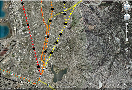
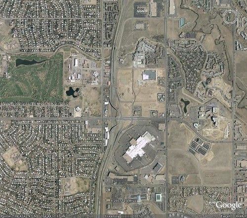
There are a few caveats including the need for quality transit and parking regulations in these centers that encourage transit ridership. But just having a center of commerce isn't good enough. Places that have a lot of jobs like Pleasanton need to be better organized and less suburban office park.

Recently however, many people have been focused really heavily on residential densities, which are important, but I haven't seen many programs that create a regional job placement and growth strategy. This could be part of the key for increasing transit's use for work trips.

I have a feeling as well that pushing for dense commercial centers with mixes of retail and office then connecting them with high capacity transit will go a long way towards increasing transit's ability to cut congestion in the peak hours. It might also be a self-fulfilling prophecy of sorts, creating a cycle of more transit and more office development in the cores of a region.

I know that this is kind of a 'duh' post. But having numbers to quantify the effects of connecting residential areas to large employment centers is really important in moving forward with policies that promote transit ridership. Thanks Prof Barnes for this paper and for your conclusion:

Planners and policymakers hoping to manage urban traffic congestion through increased transit use are limited in the short term by the strong influence that existing land use exerts on mode choice. While this point has been widely acknowledged, most research and policy discussion on this topic has focused on increasing residential densities. However, the conclusion of this article is that the development and expansion of very large, high-density job centers is the best tool available for most cities to achieve substantial increases in transit use.

While there are many ways to improve transit use, achieving the substantial increases necessary to impact congestion levels will probably ultimately require greatly improved service frequency or higher costs of driving, such as parking charges. Higher parking charges will be politically infeasible in the absence of adequate transit service as an alternative; however, improved transit service is hard to justify in the absence of a sufficiently large market.

Creating a large market appears to reduce to two options: the well-known solution of increasing residential density and the less-considered option of focusing on the work end of the trip. While both of these tactics appear to be effective in principle as well as practice, it is, for a variety of reasons discussed in this article, very difficult to have impacts on residential density that are large enough to have regional significance.

The constraints that limit the use of residential density increases as a tool are not in force to nearly the same extent for commercial development. A gradual transition of a relatively small amount of office space from isolated or low-density settings into a few large dense centers could lead to sizable increases in regional transit use in a relatively short time.

The Twin Cities area illustrates the possibilities of this approach. There are two downtowns, but Minneapolis is much larger and is geographically in the center of the developed area. Downtown St. Paul is relatively small and close to the edge by comparison, yet still attracts a substantial transit share. This hints at the possibility that even suburban locations, if they are developed to a sufficient size and density, can become major transit attractors.

Increased densities at the work end of the trip, by making improved transit service frequency more viable, could also help to increase nonauto access to retail and other nonwork opportunities. While higher density residential development can also have an impact, the effect is much larger when the increased density occurs in or around high-density commercial areas, both because more trips will be made to these high-transit attractors and because these areas support relatively good transit service going out as well as coming in. Increased commercial densities, especially in the suburbs, may be the only tool available for inducing significant transit use from the vast suburban areas of most cities that are already developed at low densities, and which will probably stay that way forever.

Tuesday, February 12, 2008

Utah - Prison - TOD

Which one of these is not like the other one? Draper City Council (Outside Salt Lake City) decided to move a prison. The reason? The land at the end of the line where a prison sits was getting valuable. Double bonus, the Draper Trax line ending there.

Salt Lake City-based Realtor Tom Cook, of Commerce CRG, agrees that the land may have grown more valuable. Depending on the zoning and amount of commercial space, the 673 acres the prison sits on could be worth $4-$5 per square foot, he said. The 2005 study found the land to be worth $2.50 per square foot.

Cook is currently working with a client developing land immediately adjacent to the prison site and said that land, zoned for commercial use, is priced in the double digits per square foot.

However, Draper could have trouble brining in additional commercial developments unless additional housing is built, Cook said. Housing built on prison land would increase the area's population and make big-box retail more feasible, he added.

...

The Draper and county resolutions contain clauses that suggest the site could be used for state university facilities or research-based centers. The resolutions also mention the possibility of mixed-use development and recommend a commuter rail line be planned to stop in the area. A sentence recommending using 100 acres of the land, perhaps for a state sports complex, was added to the Draper city resolution at the last minute.

A light-rail line to end at the point of the mountain — where the prison sits — is already planned.

I sure hope they don't build a bunch of big box stores at the end of the line. I do like the idea of University or research institutions. But the future will show what comes out of this situation.

Wednesday, January 2, 2008

Corzine Says Invest Near Transit

This is a lot of money and the idea relates to all the subsidies that Austin has been giving to companies to locate there (ie. The Domain and Samsung). The Governor of New Jersey has decided that it's worth it to incentivize companies to locate near transit. I 'm wondering if there is a better way than just throwing money at the problem he is trying to address but he's got the right idea with locating near transit.

In the final days of the lame-duck legislative session, Gov. Jon Corzine is pushing a bill to give tax credits of up to $75 million to companies that build or lease offices in urban centers within a half-mile of a transit station.

The measure to create "urban transit hubs" will have simultaneous hearings today in the Senate Budget and Assembly Appropriations committees. The seven-page bill, introduced two weeks ago, is expected to be voted on in both chambers Monday, the last day of the session.

"We're excited about the concept and we're really looking forward to answering questions the Senate and Assembly might have about it," said Gary Rose, chief of the Governor's Office of Economic Growth.

The bill is meant to expand on the idea of transit villages -- initiatives to curb urban sprawl by encouraging residential development in urban areas near mass transit -- and apply it to the corporate world. It would offer tax credits as an inducement to invest in offices in struggling cities rather than far-flung suburbs.

The Sierra Club isn't so happy with the idea and we always see folks that are skeptical of tax credits. Perhaps if the suburbs had to pay their fair share of infrastructure instead of the usual road freeloading, we wouldn't need incentives to lure companies to cities or to build more urban headquarters.

Home Values and Commuting Costs

There is an interesting article in the Pioneer Press about costs and tradeoffs of transportation and housing. I suggest the read.

Location, location, location. Johan von Thunen did not coin that adage on what determines real estate values. But von Thunen's explanations of the relationships between location, transport costs and product prices remain relevant 180 years after he wrote them.

They help explain, for example, why development reportedly is stalling in some distant Twin Cities suburbs while home values in some St. Paul and Minneapolis neighborhoods are holding steady. Not bad for an old German farmer.

...

Von Thunen also examined how a cheap transportation corridor affects property values. Suppose there is a canal or placid stream. One can load tons of rye onto a barge and move it to market much cheaper than with a wagon. Land prices are higher along the watercourse than elsewhere because produce transport costs are lower.

Ditto for the Twin Cities right now. Property prices have increased along the Hiawatha light rail line. More people want to live where getting to work is relatively cheap and convenient. In response to rising rental demand along the line, developers build apartments and condos. Neighborhood retail businesses spring up to serve the new residents.

The Central Corridor light-rail line is seeing similar activity, even though construction has not yet started. Developers are turning old commercial buildings into condos even though the buyers will have to depend on the No. 16 bus instead of snazzy light rail trains for years yet.

And yes, the same is true for communities along the planned Northstar commuter rail line. There is increased interest in buying property near planned stations.

Von Thunen predicted it all. The only difference is that commuters have replaced rye and the real estate is houses and apartments rather than sandy north German fields, woodlots and pastures.

Tuesday, December 25, 2007

Ashmont Mattapan Christmas Update

The Ashmont-Mattapan High Speed Trolley Line, the last line using PCC cars that never stopped using them has reopened after taking a short break for rehabilitation and a TOD project at one of the stations. The Bostonist has more.

Thursday, December 6, 2007

Proposal for a Seattle Streetcar Network

Some profs over at the University of Washington have done a report on how the streetcar network in Seattle can expand into 5 different neighborhoods. Their proposal doesn't give costs but lays out the amount of development that could possibly contribute to a local improvement district (LID) and TIF to pay for the expansion. The corridors would connect a larger part of the downtown to the light rail system thats currently under construction and provide a push for development close to downtown. Very interesting stuff. The Seattle Times has more. The graphic below shows the lines from the study.

Sunday, November 25, 2007

Livermore BART Extension

Driving home from Bakersfield today I was thinking about possible extensions to BART as I passed through Livermore. While I'm not sure expanding BART as a technology is a very smart idea because of expense, there are a few configurations where it might make sense. But might not. If you take a look at Pleasanton today, you'll notice that on the North side of Highway 580, there are some new very dense developments that might be well served by a good transit connection. You won't be able to see them on the aerial photo, but they are in the orange box below.

Planning for this extension has been on BART's mind for but studied seriously since at least 2003. The study initially looks at just going down the I-580 Median. Boooorrrrinnnggg and cheap. From the BART study done by Nelson Nygaard below...


The study also looks at connections to Walnut Creek, but we're going to focus on the Pleasanton area extension. Also, BART is building an infill station at Dublin. It's represented below as a black and white dot. The blue line is the Dublin/Pleasanton BART line which goes to SFO. The green line is the ACE commuter rail that goes to the Central Valley. This was also the route for the Altamont high speed rail alignment I believe.

But here are possible alignments. The yellow line is my favorite. It goes through the dense neighborhood being created to the north (orange box) and moves along vacant land that could be zoned for dense office and residential. It also passes the Livermore Airport, downtown livermore and gets right next to the Livermore National Labs facility which the north side of the station area could provide park and ride facilities for those driving over the Altamont who didn't use the ACE Train.

The red line uses the freeway until it gets to a crossover point. The cross over point allows the transit to move onto the ACE ROW and stop at stations up there. It along with the freeway median all the way out to Livermore plan are the cheap ways out. They might be cost effective but they do not provide opportunity for livable neighborhoods around the stations, since there is are 4 lanes of the freeway running on each side of the train. This will make the stations fairly auto/park n ride oriented. Also, if

Any thoughts? (The right side is cut off. Click on the picture to get a full view)

PleasantonExt

Thursday, November 15, 2007

So What Pencils?

In every city in America right now there is a fight between a community and a developer. It's happening in Austin as M1ek and AC are discussing at the moment. In this instance the community is asking for something that the developer could, but does not want to give because really why should they? The rules were laid down and the developer followed them.

So when cities come up with extensive plans for the area around a light rail station that won't be there for a few years, what is a developer or city to do? The City of Aurora south of Denver is in that predicament right now. So what are citizens who want good development to do?

One way to go is to bank the land and do something that can be easily be turned when the market changes or when the rail line extension comes. Community land trusts and affordable housing funds could possibly do this or the city could buy it to hold although thats almost like the third way below. Another is to let them develop the junk they were going to, which in the case of Aurora, like Austin, is the much hated Wal-Mart. A third and sometimes unpopular way to go is to provide incentives to make the development pencil. This is what Aurora is thinking about as well.

Bob Watkins, Aurora's director of planning, said Aurora hopes the vacant plot will be developed into "a special place that would be unique and help establish an identity for the city."

The city is currently trying to develop an incentive package for the project.

"It probably is going to require some kind of incentive package ... I think the time is right. We have things happening with FasTracks, with RTD, everything that's going on," Hogan said.

RTD plans to extend light rail from the Nine Mile Station at Parker Road along I-225 and then swing away from the highway with a station planned at the location.
A big problem is figuring out where that is going to be since engineering on LRT projects and other improvements might take years. This is where developers can take issues into their own hands if they decide to help build these transit lines. Perhaps we'll start seeing more of that soon. So when a piece of land is scoped for future development, better make sure that everything people want is in order (coding, zoning, plans, affordable housing, etc) so you don't get unlucky and stuck with Wal-Mart or providing incentives.

Update: Here is a map of the area. The line will take an angle and go right.
Update 2: Had the wrong line. Better picture below.

Aurora

Monday, October 29, 2007

TOD Reduces Auto Trips by 50%

This is pretty awesome research via Planetizen. The folks at PB Placemaking and Dr. Robert Cervero have done a study which shows that when built right, TOD does reduce auto trips by 50% compared to suburban development which is the basis for the ITE trip generation tables. Now we need to start calculating the reduction in carbon emissions and we'll be in business.

Developers Looking Down The Rails

An article in the Seattle PI Saturday was about developers and light rail. In some situations they aren't waiting for the line to come to build big projects because the market is already there for compact living. But what is interesting is that most of these guys have been snooping around the future station areas looking for other possibly plays. I'm not going to lie and say that these light rail lines don't help developers, but transit opponents complain that its a handout for developers I have to laugh. Mostly because isn't that what their precious roads are for? So that sprawl developers can build on the periphery? Yes.

But the first real surge in activity would come only after voter approval and could be restrained even then because of the transportation project's long timeline, he said. "I'm not necessarily in a position today to buy land I'm going to sit on for seven to 10 years while some massive public works project validates my assumption."

It just costs too much to buy land and hold it for a decade, until light rail comes along, Shapiro said. "Most people have to see that it's really happening. When the construction starts, then everyone takes it more seriously."

Once a light-rail route and station sites are finalized, Johnson said, property values would "really take off."

Transportation leads to access which leads to development. So the argument that its just for developers is really a non-starter because opponents development of choice is just not the development that is environmentally sustainable. And right now with the awareness of climate change, they are losing the war. Haven't you noticed the noise machine turning its volume up to 11? They are getting scared and like a caged animal are attacking with their backs against the wall. Thats when they are most dangerous. Thats also when they get ridiculous and start proposing toll tunnels under cities and super freeway expansions.

So when we are talking about light rail or streetcars and development, don't let anyone get away with the argument that its just a ploy for developers. There are always going to be good developers and bad ones on both sides of the coin. And yes they make a good amount of money, and they take a sizable amount of risk to make it. But if it is between sprawl and compact transit oriented development, I'm in favor of the access transit provides to build the compact stuff. Just don't forget to lower the parking requirements.

Sunday, October 14, 2007

Charlotte Sans Train

I went out on Friday and took some pictures along Charlotte's light rail line. In the neighborhoods along the line, there are many signs in windows displaying "Vote no" on the repeal of the transit tax.

P1000967

P1000950

P1000957

P1000953

P1000963

P1000959

I was however annoyed with the waste of space for the electric substation, basically taking up a prime parcel of property close to the tracks for one use that could have been integrated into a larger development. They might be able to salvage it, but it seems unlikely that they will try. The substation is the brick box in the center of the property below(cut off a bit by blogger). Notice how the other development builds to the line.

P1000980