Sunday, September 11, 2011

Seafarers of Scandinavia

Well maybe not, but we got rained on.  Every two years I try to go somewhere interesting for a vacation. Over the last few years I've been to Eastern Europe and Italy with my parents and sister and decided to go a bit further north in Europe to Scandinavia this time.  I try to share some photos and stories so here is my latest adventure!

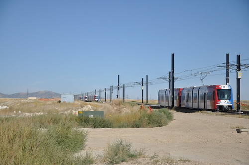
First we flew into Stockholm, some of the highlights included the awesome train from the airport that took 20 minutes to downtown at 205 km/hr.  That's one fast ride. Over the course of two weeks, we flew, took intercity rail, tram, bus, commuter bus, metro, ferry, large ferry, taxi, and yes rental car.  It rained a lot so no bikes.  But its not all about transportation.  Here are some shots from Sweden and Denmark.  I'll get to Norway in another post.

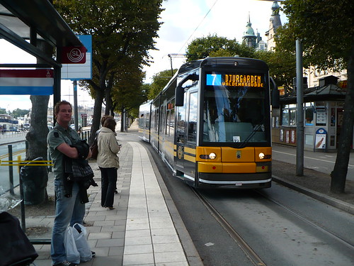
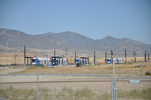
Scandinavia is famous for bikes, but I was impressed also with the subways and trams. I would be remiss if I didn't start with the Trams. This lane is shared by Trams and buses and the vehicle is a Bombardier Flexity.

Stockholm Streetcar

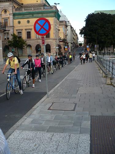
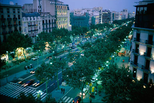
Here's Rush hour in Stockholm:

Rush Hour in Stockholm

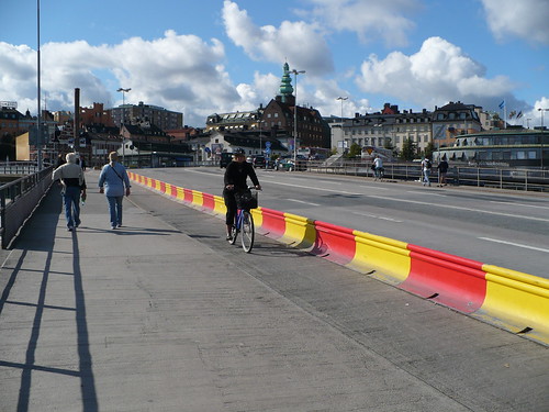
And one of the worst traffic nightmares in the city (Slussen Locks) protects cyclists with some colorful barriers

Slussen Bike Lane Barriers

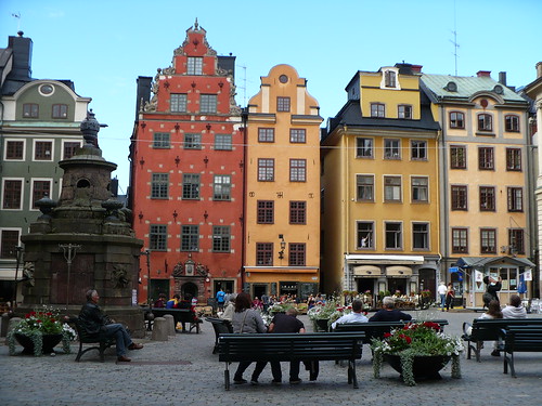
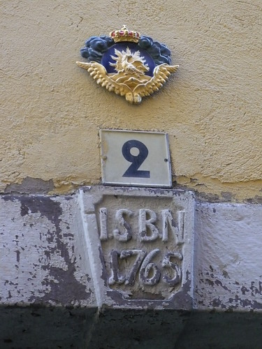
But even more fun in these cities is the old central city.  In Stockholm, this area is known as Gamla Stan. The Central Square known as the Stortorget has a fountain that is the center of the country.  Distances in different parts of the country are measured to it and it has been the location for some famous historical events.  It is said that the white stones on the red building in the photo represent each of the Swedish nobles that were beheaded in the square by the King of Denmark. 

Stortorget Gamla Stan

Back in the narrow passageways behind the Stortorget you can see small Phoenix's over windows representing who had paid their fees for the fire department to save the house.

The Phoenix of Gamla Stan

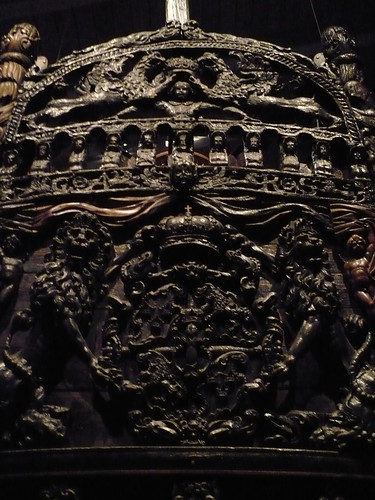
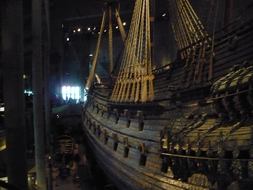
Across the lake from Gamla Stan is the 1700s Warship Vasa that sunk only a few minutes after launch and was only found again at the bottom of the lake in the 1950s. It is probably one of the most amazing things you'll see in the city.

Swedish Man of War Ship Vasa

Swedish Man of War Ship Vasa

On to Copenhagen, home of the bikes! It's a great city but I thought it felt a little less clean than Oslo, Bergen, or Stockholm.

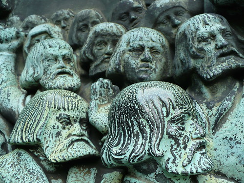
In the Assistens Kirkegaard, half park/half cemetary, noted Danes including Hans Christian Anderson and Neils Bohr are buried. It's a beautiful place.

Assistens Kirkegaard

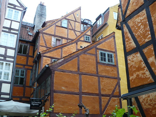
Off the main shopping street, a small back ally called the Pistolstrade will bring you to some Half Timbered buildings that are fun and brightly colored.

Pistolstrade Timbered Houses

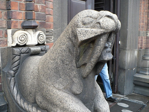
Back into the City, the City Hall is defended by a pair of fearsome looking Walruses (Walri?)

Defense Walrus

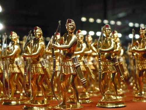
Across town at the Rosenborg Slot (Castle), the crown has been showing off the Jewels and living quarters of Danish Kings since the end of the 19th Century. These are some of the toy soldiers kept in the basement vault.

King's Men

Christian IV was the major part of the progress of the Danes and there are a number of monuments to his movement to Lutheranism around the city including this history statue. The guy was pretty hardcore. At his castle Rosenborg, there is a room with his shirt bloodied after a battle and the shrapnel pulled from his eye that he made into ear rigns and gave to his mistress. That's love right there. Or something...

The Reformation Memorial

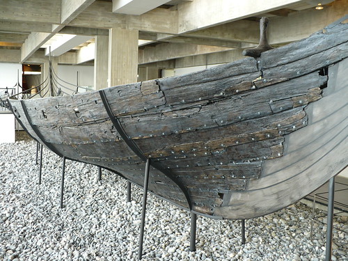
The first day we also took a train to Roskilde, home to a major music festival and the Viking Ship museum. I highly recommend it if you have kids, or even if you don't. The cool thing is that they show how the ships are built and how they used the wood to build them. This photo shows what parts of the tree they used for certain parts of the boat. Also, they've uncovered a number of viking ships including merchant vessels and warboats. Very cool.

How Vikings Built Ships

Viking Museum at Roskilde

I've got a lot from Norway as well. I'll post those later this week. Until then you can see them all on my Flickr page.

Friday, August 12, 2011

The Seats are Gross

BART is getting a bit old.  It's not New York Subway old or heck Budapest Subway old, but the train cars in the BART system are the oldest out of any in the country.  So forgive me if I get annoyed when Linton Johnson, the PR person for BART says that replacing cars is sexy while routers and other background operational stuff is not.
"Things like routers and train control systems aren't as sexy as new rail cars," Johnson said, "but you can't run trains without those systems."

You know what else you can't run trains without?  Paying customers!  Those BART seats in many of the cars are so gross looking and sagging that I refuse to sit down on many of them.  If anyone wants a tip, generally the last car on the Pittsburgh Bay Point train is refurbished with rubber floors and new seats.  Amazing what that can do to make me feel better about sitting down where a million people have been.

BART seats. Nasty.

Also, if new rail cars are so sexy, how come we didn't want sexy time faster than 40 years of the system?  And as Ben at Second Avenue Sagas says, make em plastic.  I'm not saying don't fix the bugs in the system.  Being on time also keeps customers.  But don't pit one improvement over another.  You need both. Get it done already.

Thursday, August 11, 2011

Anti-Sprawl Transit Chief?

Former Charlotte transit chief Keith Parker has pushed San Antonio towards Streetcar and BRT faster than anywhere else I've seen in the last few years.  He had just moved in to that position back in 2009.  According to the Express News, he hopes to have lines under construction by January of 2012.

The best part isn't the streetcar push though, it's that they are taking funding to spend on urban projects that would have been spent in unincorporated parts of the county.  
“Removing $55 million from the county,” he [opponent] said, “diminishes our ability to provide infrastructure services in unincorporated areas of the county.”

For those of you not familiar with Texas land use issues, unincorporated areas generally have no zoning restrictions and very little subdivision restrictions.  Regions like Houston have areas outside the city limits that form Municipal Utility Districts (MUDs) to provide water and sewer infrastructure but ultimately they end up sucking a lot of transportation funding away from cities given their peripheral nature. To be fair, I grew up in a place that was once a MUD and then annexed by Houston.  It was well planned for a burb but most of them are not master planned communities that end up with 65,000 people.

In planning school one year we had class t-shirts that said "In the ETJ, no one can hear you scream".  The extra territorial jurisdiction is a part of the county which the city can't zone but can annex, meaning you're going to get the worst sprawl you've ever seen from those parts of the region.  So with this quote I was quite happy to hear that the county wasn't going to get sprawl generating funds and that it quite possibly could be used for a streetcar.

Sunday, August 7, 2011

OT: 120 Minutes on MTV

Before I was a transit geek I was a runner.  After my freshman year in high school, I became a real runner and actually trained for it, logging around 45 miles a week then and working my way up to a few 90-100 mile weeks in college.  During that time in the summer when you were on your own to train, I would run late at night.  During the day I was a lifeguard at the local pool but at night it was my job to run.  But at times it could get lonely on the streets under the lights at about 10-11pm at night and a few times I was followed home by police officers who thought I would break midnight curfew.


Because it was such a solemn undertaking, I often brought along my walkman sports.  Because running was bouncy, I made mix tapes using my stereo from CDs at home and had a few favorites at the time.  It varied based on my tastes but this was officially the time when I started to make music a part of my life.  Many of the songs that I have in my itunes now were from that era, and I can often remember the part of the run when Depeche Mode came on or Gravity Kills.

But when I would get home from my run at midnight or so it would be about 80 degrees out still and I needed some time to cool down.  So after I had hosed off (yes I said hosed, one of the reasons why I can't stand humidity and live in San Francisco) I would come in the house, get a glass of water, and turn on the TV.  More often than not, every day but Saturday was MTV which would play videos late at night or show Beavis and Butthead/Daria.  Saturday nights was time for SNL if I could catch it.  Those were the glory days with Chris Farley, Adam Sandler and Phil Hartman.

But Sunday nights were 120 minutes, which basically got me introduced to alternative music that I ended up liking much more than what everyone else seemed to be listening to at the time.  Top 40 or country was prevalent and while I did like some Top 40, alternative was more my style.  So when I heard 120 minutes was coming back I was elated.

When looking up the old 120 minutes show archive, I was amazed at how much the show did actually shape my tastes.  Going through the videos played during each of those shows was like going back in time.  I don't have all of them on my ipod but I do know that I liked most of them.  Just going through 1995 made me smile. Bands like Catherine Wheel, the Toadies, Jeff Buckley, Blur, and the Rentals just to name a few were on the list.  If you're a lover of alternative music from the early to late 90s, check out the archive just for the names alone.  Instant memory flashback.

I don't have cable these days but I am going to watch the show online and hopefully Matt Pinfield will bring back its former glory and introduce me to the music like I remember, with back stories, associations, and random information.  That's something you can't get from Pandora or other music sharing systems and it's one thing I think that has made finding new music much less enjoyable over time.

So even though MTV doesn't play videos and got lame, if you love music, check out the first episode.

Tuesday, July 19, 2011

Bad Employment Location Decisions

Annoying me to no end are decisions to locate major new employment opportunities in areas that have no access to regional rapid transit.  The most recent of these is the idea that Berkeley Labs would take the Golden Gate Fields horse racing track and redevelop it to bring all the employees together that were once in different places. 


This is a laudable goal however it's right next to a major freeway and will basically add more transportation costs to the University, AC Transit district while also increasing auto traffic (A mention of 2,500 cars).  I'm sure my taxes will have to pay for that stupidity.  Apparently downtown Oakland isn't good enough. 

I think Auto Row might be a good location for this campus, right next to Pill Hill and Kaiser hospital.  There's plenty of space for a few tall buildings, its ripe for redevelopment because of all the parking lots, and its on a major transit route, and fairly close to BART.  Another good place would be downtown Oakland.  There's plenty of space if they really took a look.  People seem to be lazy and look for what amounts to an urban greenfield.  They really need to get an imagination. 

Monday, July 11, 2011

The Headline Doesn't Match the Story

Ok, can someone tell me if I'm going crazy here? First the misleading PI headline:
Study: Surface-transit would clog regional traffic
Then the FIRST paragraph:
The state's plans for a tolled deep-bore tunnel to replace the Alaskan Way Viaduct would bring slightly more traffic congestion to downtown Seattle than a surface-transit concept favored by Mayor Mike McGinn, according to an analysis in the tunnel project's Final Environmental Impact Statement
So the tunnel would bring more traffic to the surface streets right?  Then later on:
With no place for all 110,000 vehicles to go, speeds would decrease and fewer drivers would travel through Seattle's city center, resulting in less traffic, according to an analysis in the environmental assessment.
The idea is that surface transit would make through traffic harder, and people would be annoyed and say I'm not going to make that trip.  That is a great result!  But that headline suggests that it would clog traffic all together when that is not the case.  I'm guessing some headline writer at the PI thought it would be good, but it totally shows some serious windshield perspective.

Going Car Free in San Francisco

Funny story, I just had a little freak out about whether my car was parked on the right side of the street or not for street sweeping in the morning.  If you don't move it, you get a ticket.  But the freak out was unfounded because then I realized that I don't have a car anymore.  

I sold my beloved Volkswagen Jetta I nicknamed "The Green Goblin" on Saturday. There have been many good times in that car that I've had for 12 years.  It's been across the country a few times, was put in a classified ad as a part of a prank war in college that had people calling and asking if my brand new Jetta was for sale for just $2,000 and been splashed by cattle poo flying from a cattle car in Colorado.  Its also served as sleeping quarters outside the four corners and been across the great state of Nevada on Highway 50 at speeds I probably shouldn't mention.

I've lived in San Francisco with the Green Goblin for 5 years and it served me well. I was able to take people around the city that came for a visit and go on day trips around the region and city to places I couldn't easily get without it and generally on a whim.  There are many benefits to owning a car, generally the mobility they provide is excellent and because i'm a city planner I like to know my surroundings, including random streets and quirky places that you might not know about otherwise. 
 
But moving my car because of street sweeping was a pain and I racked up a lot of tickets. In fact i'm sure that I more than paid for better Muni service that every citizen in San Francisco actually deserves rather than what they get.  If everyone paid as much as I did every year we could build a real subway network in this town and everyone could go car free, but I digress. The only time of the week I used the car was going to visit my Gramma in the east bay on Wednesdays.  I've been walking and biking there from BART the last few weeks and its been some really good exercise as well as an exercise in patience when dealing with BART's rules about bikes during rush hours.
 
Ultimately though, the clutch went bad and it was time for me to practice something I talk about at work all the time, living a car free lifestyle.  I've never really advocated it before but seeing all those affordability index charts must have gotten to me. To see what its actually like to go car free, and be able to see the actual costs of driving when I use a zipcar will be refreshing but certainly a little scary.  But for now, its just my legs, my bike, my Clipper Card and my Zipcard...and perhaps a taxi after a night at Polk Gulch.  I really wish someone would survey me for the census now with the long form...


Monday, June 27, 2011

Comings and Goings

I went out for a bike ride on Sunday.  Here's some fun stuff that I saw.  I streetcar turnaround up Market street and the value of a bike lane on the Embarcadero...

F Line Turnaround


Embarcadero Free Ride

Sunday, June 19, 2011

Transportation Bill Downfall Parody

It was only time before this happened. Anyone else tired of waiting for a transpo bill?

If you haven't seen a downfall parody before, you can find some really good ones here. This one, Hitler finds out about the downfall parodies, is quite hilarious as well.

Caution, harsh language.

The Need for Speed

I enjoy my trips on BART to my Grammas house.  Especially when Highway 24 is moving slow but I'm moving soooo fast.

Wednesday, June 15, 2011

Livermore Again

I keep writing about Livermore because it annoys me.  Do these opposition people not realize how bad it looks to fund a line in the middle of a freeway that will cost a billion dollars and only get about 5k to 10k riders? (I don't believe the happy ridership estimates they give in the alternatives analysis)  If you spend $500m on the 30th street BART station you'd get 15k riders and greater VMT reductions. Not that the locally preferred alternative is that much better, at least it goes to the center of Livermore, giving the city an opportunity to build up around it.

This brings about the point that there needs to be a serious discussion about how many riders our investments are getting for the money.  I know it's a bit more complicated than just riders and funding, but ultimately Livermore shows that we need more education on why connecting actual places is so important.  It gets riders, and allows a place decide its future.

Off the Line in Houston

Houston has been studying constructing a commuter line down the 249 corridor but if it plays out as usual, it's going to skip a number of employment centers because the freight right of way just skirts them.  Currently the study done by the HGAC states that its not one of the main corridors and that ridership will only be about 5,000 riders.  This is a miniscule amount but the reasoning is simple, it doesn't connect the center of the most important trip destination on the North End, the former headquarters of Compaq computer.


Since these buildings are going to be the central piece of a redevelopment strategy for the area, it would also be good to start thinking about how to develop the rail line to connect this place.  

But how would that even be possible?  They are so close yet so far apart.  This is part of the problem with focusing on commuter rail in existing freight rights of way.  In this instance, is a freeway alignment better than the freight?  It sure looks like it, because it then becomes at least a little walkable, meaning more workers would use the line.  I'm not holding out hope that this will actually happen though.  

Wednesday, May 25, 2011

Loop Roads or Bust

It's been open season on long term capital improvements for fixed guideway transit.  First there's Minnesota Republicans looking to hack into transit by stealing operating money.  Then you get the fun times in North Carolina where Republicans are trying to cut out funding for the North Corridor light rail line.  But I found the article a bit funny, especially when they were saying, we don't have enough money for transit but more than enough for a completely un-needed beltway.  
...it would kill Gaston County's proposed Garden Parkway toll road, using money from that project for urban loop roads, perhaps including Interstate 485.
You know, that loop road that developers really want for their sprawl. And then...
"We wanted to target more dollars to maintaining the system we have - as opposed to building new roads, new bridges, new parts of the system," said Senate Leader Phil Berger, a Rockingham County Republican.
How the reporters didn't see this and do a double take on the building loops and not spending on new roads is beyond me.

Monday, May 23, 2011

How to Free the Market and Reduce VMT - Austin's West Campus

When I lived in Austin I ate dinner and lunch every day at a place called the University Towers. Rather than paying $10 a meal at the athletes dining hall my teammates and I could get a meal plan at the private dorms for about $4.50 a meal. For athletes that ate a lot this was an amazing deal and also good time for teammate bonding. It was such a great deal that I ate there with my old teammates all the way through grad school. I had the choice so why not take it?

To get there I had to walk through West Campus every day. I often thought that it was underdeveloped and a bit ragged and would dream about how things could change with a little development on my ride home either on the #1 or the #5. That dream seems to have come true, perhaps a bit more than even I thought possible.


In Austin if you heard West Campus in the first half of the 2000s, you might automatically think of the dense neighborhood West of the University full of frats, sororities, and kids with extra money to spend in order to live closer. If you had less cash, you lived North, South, or on Riverside. By the time I left, the city had finally upzoned the neighborhood, much to the chagrin of some neighbors that lived in the area, to allow redevelopment of properties that had fairly poor upkeep due to the captive audience of students and the very limiting height restrictions against heavy demand. I found that a post by the Old Urbanist was very informative on this point and I didn't realize it matched that until today.

Basically, the rent was high but much of the quality was horribly low. When looking for an apartment one time I remember this one place called the Sandpiper. It was one of those old motel looking complexes. For $850 a month you could get the worst two bed room in West Campus. And that was back in 2002.

As Chris Bradford at the Austin Contrarian shows, there was a lot of development that took place and the census shows that the area had really high growth rates. So high in fact that recently there have been rumblings as to whether the infrastructure could handle all the development. Well after the rezoning it seemed like there was a new crane in the sky each month. This led to around 3,700 new residents according to Chris' calculations.

At that same time, Riverside which was a popular area for students when I was in school seemed to be declining in population as a whole losing over 2,000 residents. Additionally, ridership on the West Campus bus has gone up while overall Riverside ridership has dropped.


According to numbers provided by Capital Metro, (thanks to JMVC) ridership in the fall, which has greater ridership than spring, has increased for the West Campus bus by ~1,200 students a day between 2006 and 2010 while the Riverside buses have lost about ~880. Obviously correlation is not causation but you can make a pretty good bet that there was some sort of shift happening. And it wasn't just coming from Riverside, but probably all areas of the city where students were living. Given the rise of 3,700 residents in West Campus, you would think there would be an even greater ridership bump on the West Campus Bus. But a lot of the new folks probably now just walk or bike.

But what else does the shift mean? Well for one thing I think that West Campus gives us a perfect example of how zoning close to Downtowns in major cities can stifle what the market actually wants to provide. Given the choice, I don't know of any college students that wouldn't love rolling out of bed five minutes before class (8am or otherwise) with the ability to get to class on time because they just had to walk or bike quickly. Additionally, there are a lot of people that want to live in proximity to great neighborhoods just outside of downtown in most cities.

But that's also another piece of the regional and national puzzle, if there was a shift from Riverside to West Campus of 800 former Riverside riders or so, that is likely a huge reduction in VMT. Mostly because if you live on Riverside, you own a car and have to drive everywhere. Though the grocery store is close to many of the apartments aimed at students, you couldn't just walk to the library on campus to study or go to parties in West Campus Friday nights. Driving was the only option. Not to mention that the bus passenger miles were much higher going to school.


Checking the Walkscore for Riverside and West Campus, you get an idea of what happens. As you can see below, the Walkscore for Riverside is 56 with the neighborhood the 40th best in Austin. That means lots of driving. Over in West Campus, the Walkscore is 86, second highest in the region. Imagine the VMT difference of those 3,700 new residents now living in West Campus who probably walk to Double Dave's for some pizza rolls rather than driving there.


And I didn't have a lot of time to look at it, but if those 3,700 residents moved out of housing in Riverside and other student areas, and the demographics of those areas changed. Does that mean that these areas became more affordable? Did the rents change? That would be interesting to look at as well.

Ultimately I think this is a lesson for other cities as well. Folks like Lydia DePillis in DC arguing against the height limit should not look to Austin's future plans, which looks like more skyscrapers on the way, but rather to what they've already done with changes in zoning that freed up the market in West Campus. Additionally, the Georgetown folks could learn from this as well.

Austin can learn from itself too, as Chris discussed in his post about the Suicide Pact. Not only is it about schools and kids, but its about quality of life for the region as a whole. Reductions in VMT will come when people are able to live where they want. There's a high demand for walkability and proximity to work and less time spent in cars. In that sense, people already want to do the right thing, we're just not letting them.


Capital Metro UT Shuttle Data Extra...

Tuesday, May 3, 2011

BART to Livermore a Horrible Idea

There I said it, BART to Livermore is a bad idea. Even if we could make the line downtown less expensive, it would still get minimal riders unless Livermore decided that they were going to make a massive push to make downtown an employment center. We know that's not going to happen, so we shouldn't even be building a BART line there. It's just not worth it.

That's not to say you shouldn't build transit, but if you want to spend 3 billion dollars to get 30,000 riders, why not build infill stations at 30th street and San Antonio? I bet that would cost less than a billion dollars. Then take the extra two billion that you would spend and put it towards a regional Geary Subway and second tube that would end up getting 100,000 riders a day and perhaps allow commuter rail lines from around the region to get into San Francisco's Transbay Terminal. You know, make it more Transbay than just bridge buses.

But it looks like we might not need to even try to kill this line, because the NIMBYs who only want a freeway alignment will do it for us. The only way that a line would have worked out there is if it picked up the employment centers and dense housing in Pleasanton and Livermore.

Sunday, May 1, 2011

50 Years for a System?

The Twin Cities finally signed its full funding grant agreement(FFGA) with the FTA for the Central Corridor. This just 7 years after the completion of its first light rail line, the Hiawatha. In the meantime the Northstar Commuter Line was completed. Now they are planning for the Southwest Corridor and gearing up for that long haul fight as well. With any luck, that line will be signing its FFGA in less than a decade. But why does it take so long to build these transit lines and why are regions doing them one by one? Well, the answer as usual is money.

However of all places, Los Angeles has provided a discussion spark. The 30/10 program now nationally renamed America Fast Forward has pushed the Transit Space Race forward at least an inch, giving hope to regions tired of doing things one line at a time. Salt Lake City has proved expansion can be done on time and on budget and now other regions are starting to think, why not us? The Twin Cities is no different, with local leaders seeing the possibilities.

I'm hopeful that this will push the discussion along as to why it took ~40 years to build a network of national freeways but it seems like building out real transit networks in cities might take over 100 at the current pace. It's not like there aren't a lot of projects out there (complete excel sheet on the page). In fact, there are over 600 fixed guideway transit projects and that doesn't even count all of the frequent bus and trolley bus service that is being planned. That's not to say that all those lines are good lines, but they are out there.

I can only hope that we move past the one line a decade mentality and build lines that matter.

Saturday, April 23, 2011

Transit to Empty Fields

In the United States we haven't been able to talk a lot about transit creating new neighborhoods whole cloth since the early 20th century. Now places like Portland have been able to take abandoned rail yards and turn them into new neighborhoods with a walkable street grid and amenities.

In Europe now, it's being taken even further. Eco suburbs in places like Freiburg are popping up and development is happening as tram lines are planned. The map below from a paper written by Berkeley student Andrea Broaddus shows the expansion of the network.

As an interesting side note, Broaddus' study noted that two ecosuburbs were the same except for parking provisions:
Travel behavior data showed that residents of Rieselfeld had higher rates of transit use in an otherwise typical modal split, while Vauban’s residents had extremely low car share and high bicycle share. These differences were attributed in part to more Vauban’s more restrictive parking policies.
But back to the Reiselfeld. Of interest here is how the development was conceived. The tramway was built before the development and historical Google Earth images show this development happening.

Reiselfeld in 2000


Similar image from a different angle, from The Modern Tram in Europe.

And a more recent image in 2006


To me this is awesome. This is true transit oriented and development oriented transit. Could we ever do something similar here in the United States? It's already happening. Though perhaps not as eco-friendly or dense as would be most sustainable.


Salt Lake City is building the Mid Jordan Trax line into the Daybreak Neighborhood drawn up by Calthorpe. While all the houses are planned to be a five minute walk from local shopping and destinations, there are still a lot of single family homes. Additionally, there is a freeway that is being constructed up the left edge of the valley that will just make Utah's air pollution and inversion days that much worse in the future.

Image courtesy of Calthorpe Associates:


Salt Lake City Suffers from Wicked Inversion Days

Ogden Trip

Flickr Photo via UTA

Mid-Jordan TRAX Segment Map

Daybreak Under Construction - Flickr Photo via Jason S

Daybreak Trax Station

Daybreak Completed - Flickr Photo via Brett Neilson

New Tracks for Trax

All the negatives aside, I think its an interesting experiment and one worth watching. And watch from the air we will...

2003


2005

2006

2009


More Flickr photos at Daybreak from UTA

S70s In The Distance

New Vehicle Testing at Daybreak

And finally a little easter egg for LRT Vehicle nuts.

Monday, April 18, 2011

Planners Using Twitter

As many of you know I tweet as @theoverheadwire. Same planning stuff with a bit of personal mish mash. It's interesting to see how we use blogs and twitter differently. As of late, I've stopped posting a lot of my Notes posts and left most of the articles to twitter. Sometimes that's annoying as it doesn't allow much editorializing due to the character limit, but it allows me to do more generally.

In any event, I think twitter can be used effectively. I recently had a phone chat with Kristen Carney (@cubitplanning) about how I got started on Twitter and why I use it. I'll admit, it's not for everyone, but it certainly is useful at finding lots of quality information and news. And no, you don't have to know whats going on with Britney Spears or Ashton Kutcher because you can choose not to follow them!

Also, Kristen has a post about twitter happenings at the APA conference.

Thursday, April 14, 2011

No More Commuter Rail Starts

If there is one thing we've learned over the last few decades, suburban political forces are a drain on cities. For everyone wants to be connected into the downtown and its vibrancy but at arms reach. So the wall was put up many years ago, you must have a car to get there. Now many are wondering if there is an easier way to get back downtown, wherever downtown is. And then they say, well it's too congested to drive, how can we get downtown to pay and appease the folks that want transit but aren't quite sure what it is they need. Then the answer comes, commuter rail.

It's a perfectly acceptable form of transit and has its place in the hierarchy, but for some reason regions get stuck on building rail and they look at what it will cost to do the first part right and they balk. How can we appease our overlords in the suburbs so they will give us something we in the city want in the future? Why do I say overlords? Because Metropolitan Planning Organizations and transportation providers as well as the congress is stacked with people who want to suck money out of cities and into their suburban and rural districts. The safe bet is to appease them right? Wrong.

What we've seen over the last ten years is the monumental failure of commuter rail to do any regional work of value as a first line. The millions of dollars for a couple thousand riders at best is disheartening to those of us who want to see regional transit systems, not just a one and done. I've started to think about this with more clarity as the research comes in and I believe that the places who really are in it to win it will build destination based regional transit that connects a major employment corridor in the region. The headways need to be frequent and the line must run up the gut, not on the perimeter.

Houston's LRT Line

Here is the political reality facing regions today that don't have transit, especially in conservative or timid parts of the country. There seems to be this weird wishfulness that somehow commuter rail taking 2,000 people a day is exactly the way to cure congestion or spruce up economic development. However its basically a ticket to political backlash. Sure the line might have met ridership expectations but who cares? That's only 2,000 voters a day. How much induced voting demand did you create by freeing up room for 2,000 others cars on that freeway carrying 100,000 a day? Zero. It just means 2,000 more freeway voters can move into that district.

Here's what you can do. Put a light rail line down a major arterial between major destinations and all those haters that work downtown have to see the train pass them full at rush hour every day. When I was little my dad liked to play a joke on me that there were no boxcars in Bakersfield California. He still to this day will not acknowledge their existence because he knows it gets me really worked up. But the reason it got me really worked up is because I saw them in the yard downtown next to the high school ever single day. I saw them every day we would go pick up my sisters at school. If you saw a light rail train full of people at rush hour every day wouldn't you start to believe too? Once entrenched as something that works, no one pushes back, rather they want it in their part of town too. That is how systems get built.

But let's look again at why commuter rail is not the start.

1. It's got low ridership. These lines don't have that many people on them period. So people don't see the effects and they don't want more because they don't feel like they are missing anything. Lines like the Music City Star, Capital Metrorail, and Northstar are all carrying minuscule amounts of voters.

2. It's got low ridership because the schedules are bad and the schedules are bad because you're second fiddle to freight lines. If you're not giving commuters priority, why should they give you priority?

3. It was too easy. If a region builds a line because it was cheap to do, don't you think people are going to see through that and understand that you're not really putting a full effort in? I know I do. Indianapolis wants to build a cheap line because its politically feasible now. What about in 5 years. The harder the fight and the more work you put in, the more likely you'll be in good shape down the road. In running, you get out of your training what you put into it. I think the same applies here.

4. You're enabling the enemy. Same as the last point, but if you're not putting voters and supporters on the trains, you don't have a constituency for extensions or stopping service cuts.

Look at these lines according to the Q4 ridership numbers, you can quibble with these a little bit as the agencies have different numbers in the news recently but 500 +/- riders isn't going to make a huge difference.

Recently Opened Commuter Lines

1. Northstar Twin Cities - 2,000
2. Capital Metrorail Austin - 800
3. Rail Runner New Mexico - 3,800
4. Music City Star Nashville - 800
5. Frontrunner Salt Lake - 5,400
6. Portland WES - 1,400
7. Oceanside CA - 4,100

Some of these places like Portland and Salt Lake City already have regional light rail systems so a Commuter Line connecting in isn't as bad of a decision for later when you have the internal network.

Single Destination Connecting Lines Opened in Last 10 years. Again the ridership differs due to gas prices but these are in the rough area of current reality

Houston - 34,600
Phoenix - 40,300
Minneapolis - 30,000
Charlotte - 14,000
Seattle - 24,700

Now the difference between people packed into trains running downtown as well as the number of carried voters is huge. It doesn't take a rocket scientist to tell you which ones are going to be more palatable for expansion. So instead of looking at the "cheapest" alternative, let's find the two major destinations in a region that need more capacity and need to be connected. This is what we should be thinking of when we're starting a system. No more commuter lines as regional rail starters.

Monday, April 11, 2011

Monday, March 28, 2011

Bay Area TOD Policy Might Work

We've had lots of discussions about freeway running light rail and transit and some folks say its ok as long as the major nodes are connected. I probably subscribe to that version, but when it comes down to it I'd rather have the ends of lines not be parking lots. That's why I was glad to see that the BART to Livermore extension was actually going to end in downtown Livermore, not along the freeway. This was thanks in part I believe to the MTC TOD policy, which states that you need to have a certain amount of housing units to build certain technologies like BART. Now of course that policy in itself isn't as powerful as it should be but at least its a good start.

However that won't stop some folks in Livermore from arguing that they thought the line was going down the freeway median all along. What's the point of building a rapid transit line like BART if you're just going to park cars around the stations?! Apparently some people don't get this.
"I guess the thing that's hardest for me to comprehend is that they're putting this train right down the most populated part (of the city) they could come up with,"
Because that's the point! Going to the most populated places so the $3.8 billion line will actually have more riders than parking spaces is the goal. I would personally do it a little differently, but that's just me.

Monday, February 21, 2011

Density Lobby Uncovered!

So according to Joel Kotkin (only go to the link if you have to), the Density Lobby is made up of the following nefarious groups:
Then there’s what might be called the “density lobby” — big city mayors, construction firms and the urban land owners.
Even Tom Rubin, a self proclaimed train lover and "transit expert" who has never recommended a train in his Reason Foundation consulting history, gets in on the action.
“High speed rail is not really about efficient transport,” notes California transit expert and accountant Tom Rubin. “It’s all about shaping cities for a certain agenda.”
Why would Mayors of big cities surrounded by suburbs ever want to promote density or a (gasp!) agenda!? I mean San Francisco has so much room to grow. The Pacific Ocean is endless! Also, damn those "urban" land owners for wanting to make money. As opposed to the angel pure "suburban" land owners and road construction firms. Seriously Joel? Is Siemens wanting to build more trains not as bad as Ford wanting to build more cars?

I'm also a member of the density lobby as are many other amazing bloggers and activists out there who share a love of density. Perhaps these mayors, construction firms and urban land owners would like to become card carrying members.


Also, this article mentions boondoggle for the third article today (see post below). This must be one of the talking points sent out by the RNC this weekend along with the "Obama is so out of touch he wants to spend money on trains" meme that showed up on the weekend talk shows and in various seemingly random articles this weekend.

This is a Boondoggle

This is a boondoggle. It's a craft project that we used to do in Boy Scouts so that we had something to put our keys on.

via Etsy Crap

Now, the overuse of the term boondoggle to describe projects that may or may not be bad but rather the writer doesn't like because its a hefty investment is epic. I find that its mostly writers and columnists who also use the phrases:

Streetcar Named Desire - Seriously. Stop it. It wasn't cool the first time you thought of it for an article headline, what makes you think its original the millionth time? Searching for an article on streetcars shouldn't bring me every mom and pop production of a a Tennessee Williams play.

19th Century Technology - So was the car. Karl Benz is the originator of the four stroke engine we know today in 1885. Frank Sprague made electric traction (electric railways) usable en masse in 1887. Also Portland Cement that we use in concrete was from the 1840's.

Driving pays for itself - I'm not going to waste time typing what people that read this blog already know.

If anyone has any other terms that the opposition uses that drive you nuts because of their truthiness, please use the comment section below. I saw boondoggle for the umpteenth time today while reading some articles, and it kinda made me want to hurl. But I wrote this to vent instead.

Thursday, February 3, 2011

Thursday Night Notes

Some notes for the weekend...

If road projects like this one had to go through new starts they would never get built. This road like all other ring roads is about development. But you're not allowed to build a transit line and let ridership grow. It has to be on target! Double standard.

~~~

Ed Glaeser floats the "We should invest in NE Corridor for HSR only" meme that's going around. See post below. Also, how can you say we shouldn't be building major city pairs for places that do already have the density? I never understand the idea that we should just wait until conditions are just right everywhere. That's just a stall tactic.

~~~

If transit were all designed to look this good maybe more people would ride.

~~~

THIS is the reason for my skeptical nature on BRT. People in Berkley or in West LA are going to screw the whole plan to make it worthless. You spent all that time to get what? A red bus that skips a few stops?

Tuesday, February 1, 2011

Northeast Corridor Rulez!

I appreciate the Northeast Corridor and would love for us to spend more money there. But don't screw over California or other mega regions to do it. Last week Mayor Bloomberg was talking about the national investments in HSR (from Second Ave Sagas) and it seems like he's taking the attitude that investing anywhere else is silly because the NE Corridor is where its at.
With projects in Florida, California and the Midwest garnering headlines, the Northeast Corridor has taken a backseat in Washington with only one percent of federal HSR funds coming our way. “That simply just doesn’t make any sense,” he said.
Sure it makes sense, but not in the way that he wants it to. I would LOVE if we doled out money based on merit which we're starting to do with TIGER and HUD grants but then those people that are elected called politicians in places that don't have a lot of population concentrated don't want their money all sent to the Northeast Corridor. Not to mention that sometimes I feel like people don't understand geography or population of the rest of the country (not readers of this blog of course). I can't tell you how many times people say they'll be able to hop up from San Diego to visit San Francisco. When I ask them if they like 8 hour drives they say "WHAT?!"

Also, just adding up from Wikipedia CSAs and MSAs not in CSAs, along the California HSR corridor we get the following:

Los Angeles CSA - 17,786,419
SF-San Jose-Oak CSA - 7,427,757
San Diego MSA - 3,053,793
Sacramento CSA - 2,436,109
Fresno CSA - 1,063,899
Bakersfield MSA - 807,407
Stockton MSA - 674,860
Modesto MSA - 446,997
Visalia MSA - 429,668 !B9871841047192


Merced MSA - 245,321

Then there are a bunch under 200,000. But that is ~34.4 million or 11-12% of the United States population. Compare that with the NE Corridor numbers from the New Republic blog post on Mega Regions. From the graphic we can add up to about ~44.2 or 14-15% along the NE Corridor. I left out Springfield and Poughkeepsie.

In any event, I hope these loosely added numbers put some things into perspective. I wasn't quite sure what I was going to get out of it but felt like it was close. I'm guessing that the Midwest Hub HSR network probably puts together city pairs that add up to a lot of population as well. The difference between the NE Corridor and other regions though, is that the NE Corridor exists, Amtrak from San Diego to Sacramento or San Francisco does not. Again, I'm not saying don't invest in the Northeast Corridor, or that medium speed rail is a great idea (that's a whole other post) but also let's not pretend like the Northeast Corridor is the only place where HSR can exist. It is not the center of the Universe. That is the Planet Nieuw-Vennep.

Tuesday, January 25, 2011

Unconventional Thinking On Charlotte

A lot of times I'll see an article or a piece that I want to comment on but hold off to see if more of a complete picture comes through. I'm glad I did this time because I've waffled back and forth on the idea of Light Rail on Charlotte's Independence Boulevard. When the debate raged between BRT and LRT on this corridor back in 2005-2006 I felt like BRT would have given the corridor a raw deal. Partly because frequencies and vehicle capacity would mean much more in operating costs even if the capital costs were lower.

At that point there was a lot of support from local mayors (like former Matthews Mayor Lee Myers) and communities for the light rail line but as usual no money. So the decision to pick a locally preferred alternative was shelved for a later date several years down the road when there might be money available.

However recently Mary Newsom at the Charlotte Observer tweeted then blogged about a ULI session that suggested that Independence should be HOV lanes and a Streetcar should be run up Monroe Road. Yonah has a good graphic for this over on the Transport Politic. Initially when I saw the tweet I thought that was a really dumb idea. I had seen the fight between LRT and BRT before and the current suggestions were for the line to be a rapid bus line in the HOV lane and a streetcar on Monroe Road.

While still rapid transit, all that type of transit would do is reward people living further and further away from the city without changing any of the land use patterns closer to the city center. The streetcar might do it but I'm starting to wonder whether line haul streetcars are a great idea for places that would rather have more rapid transit options. Just as Yonah points out, you aren't really going to be getting anywhere fast.

But then I started to warm up to the idea of HOV lanes considering that freeway alignments don't really work well for TOD considering most of the really good property is taken up by the size of the road. Especially if the road is going to be the size of a freeway at some point ceasing to be an actual boulevard. But that is the rub.

The problem here is the same problem that's happening when TTI releases its urban mobility report based on a travel time index. All the engineers at the state DOT care about at this moment are making the trip from a place outside of the Loop into downtown faster. They want to widen this road and make it a full fledged freeway. But that decision alone goes against the centers and corridors plan that Charlotte developed after they voted for the half cent sales tax initially and revamped in 2010.


The TTI travel time index is the wrong measure, especially if it is going to push infrastructure investment that drives the vicious cycle of speed to further away parts of the region. We know now rather that access is a more important measure. CEO's for Cities laid it out in their Driven Apart study, showing that travel time skews the data towards travel flow rather than closer access to work or other destinations.

What this means for Independence Boulevard is that if the NCDOT gets a hold of it and upgrades the outer sections to a grade separated highway, then the ability to change those patterns for better access to an employment node is lost forever. One of the commenters on Yonah's post noted that the outermost piece of Independence is actually a boulevard instead of a highway. Not a boulevard in the sense of a grand boulevard but it is still not a grade separated highway.

The one problem with changing it to a grand boulevard is that urban development patterns that people like are harder to realize further from the downtown or major employment cores. Because of land values and other market forces, the further you get out from major gravity centers like downtown Charlotte or the University, the harder it gets to realize new urban style development. In fact, the South Corridor already shows that development further out is harder to realize. The map below shows development projects from 2007 and before on the South Corridor. The basic distance from downtown before development starts to wane is approximately 3.5 miles. Basically, the strong market of downtown seems to be extended with access provided by the transit line. This is about a 13-15 minute trip to downtown.

Source: Realizing the Potential One Year Later

Part of the reason for this is the travel time people are willing to endure to get downtown. It's not likely that people will take the streetcar from the outer edges of Monroe Road or Central Avenue unless they have no other options. Additionally, this is why an Independence Light Rail line gets a bit tricky. But we need to start thinking of Independence not as a corridor feeding downtown but rather as a future mass that will have its own gravity. And I believe that gravity can be achieved with a strategic investment in the road to make it an urbanism changing Boulevard.

Considering the section of Independence that is already most like a freeway is within the 3.5 mile radius, its hard to imagine much happening in the short term along the Boulevard. Below shows the ~3.5 mile radius. The yellow shows the part most like a freeway already. The red shows the Boulevard and the light blue is the railroad corridor that is parallel to Independence. The Orange is the Central Streetcar.


This means that a Monroe Streetcar would be good for the inner 3.5 miles but two different service types will be needed further out for shorter and longer types of trips. This also leaves an opportunity for a Grand Boulevard that can attract business and development over time if the road is done right and parcels are slowly transformed into gridded and walkable areas. The approximately 120 feet of right of way are more than enough to build a road that would be friendly to transit, bikes, pedestrians as well as autos.


This corridor specifically could pull offices out to 7.5 miles, creating a new employment corridor which could bring land values up and with it densities over time. Creating a new center should be the goal, not making it another pass through on the way to downtown with HOV lanes for buses that are going to get 5000 riders a day at best. Additionally, by creating two centers with a rapid transit line and streetcar between, the market between the two centers gets stronger, allowing it to support the types of urban development people always draw on their maps at public meetings.

Photo via Hugeasscity

I realize this might be a bit too forward thinking for some people but ultimately we have to change our mindset about what is possible in urban places if we are to give people opportunities to choose different housing and mobility types. Yes this corridor is going to be auto dominated for the near future but that doesn't mean we have to doom it to freewaydom and forever feed sprawling development patterns further and further out. In fact, it's possible to create a new center that attracts new transit trips from within its own gravitational field.

Monday, January 10, 2011

OT Running: Interview With Me Not About Transit

For those who have followed this blog a while, you know that before I liked talking about transit I ran a lot. A friend of mine from college recently interviewed me about my days as a runner and allowed me to give some tips for beginners. So if you're interested, head on over to her site to check it out. (There's a part 2 as well)

Thursday, January 6, 2011

Indianapolis Follows The Wrong Footsteps

In November an Indianapolis group called Indy Connect released their long range vision for transit in the region. It's chock full of all the stuff transit geeks love including lines on maps. I'm not going to go into the details of the plan as Yonah at Transport Politic has already got that angle. Additionally, the locals at Urban Indy have done a good job getting the initial reactions from folks on the ground.

But I definitely approve of bringing down the bus headways to real levels that would start to make ridership equal that of other regions of similar size. Places like Austin, Columbus, and Charlotte are similar size with daily ridership much higher.

Austin - 108,300
Columbus - 58,400
Charlotte - 103,500
Indianapolis - 29,700

But that's not really the issue I wanted to address. Also in the plan are several commuter rail lines, light rail, and BRT that isn't really RT due to its lack of dedicated lanes in the plan. The light rail has been pushed back I'm assuming based on cost and the first rail corridor they want to build is the Northeast Line. While this looks like the deal of the century, they should really take advantage of the fact that they are late to the Transit Space Race by looking at what other regions have done and the consequences of their actions.

Politically it looks like a short term winner with a long term loser. Build the commuter rail line on an existing freight rail ROW on the cheap to get voters in suburban jurisdictions to buy into the plan. They'll vote for it because its cheap and the voters of the main jurisdiction will think they are getting a rail line because that's what you're selling with pictures of commuter lines in Chicago and Philadelphia and Austin. But the people that really want it will just get bus lines for their trouble.

Curious that last city I listed. Because they went first, Austin tested the waters with this type of plan. Back in 2000 there was a light rail election that lost by less than 2,000 votes because George Bush was on the ballot among other reasons. That line would have hit all the employment centers and gotten about 37,000 riders, more than all of Indianapolis' transit does now. But it lost, so in 2004 Austin got the politically palatable solution that is now a commuter rail line taking about 800 riders a day from Leander to the North to the outskirts of downtown Austin. Take a look at these cities aerial photos and let me know if you see something familiar.

Indianapolis - Left Yellow is the University, Middle Yellow is Downtown, State Capital and the red line is the commuter rail.


Austin - Top Yellow is University of Texas, Bottom Yellow is State Capital and Downtown


See a resemblance? Both lines skirt places people want to go. Austin's line gets around 800 riders a day. For the last 6 years Austin has been discussing urban rail to go places where the commuter rail line did not go. However the plan keeps getting pushed back for a number of different reasons that are mostly political. But if they would have done the right line first, neighborhoods all over the city would be begging for extensions to a current system. The politics would be a no brainer but as it currently stands, people are still a little hesitant to put their money where their mouth is in terms of an actual urban rail plan in Austin. That's not to say they aren't working on it, but it's a very uphill battle.

That's the political price that Indy is going to pay if they build the NE Corridor first. Forget all the good will of increased headways and higher ridership for the rest of the system. Charlotte has shown that people won't remember you for your increased ridership. I'm guessing that before the 1998 sales tax increase, Charlotte was in a similar place as Indianapolis is now. But the opposition picked apart the half cent mercilessly and focused on the train. Luckily the train was a success and Charlotte saved their half cent sales tax from repeal, but the attack was on right away. So in a place like Indy where people are much more afraid of taxes for these types of expenditures, if you're going to build a line, do it right or that cheap victory is going to end up being an expensive long term defeat.

But where should the line go? Well let's look at Austin's 37,000 expected ridership year 2000 alignment or Houston's line that passes 290,000+ jobs or even Phoenix which hits the major downtown corridor and Arizona State. It's about the job connections. These lines connected jobs to people. So where are Indy's jobs?

Looking at LEHD data from On the Map, we can see that employment is clustered around the CBD and State complex. The University is a major employer as well to the west of the downtown cluster with the big red dot. (Red = 10k jobs)


But take a look at where the Red line goes, which is the Northeast Corridor. The yellow line is my idea of where a transit corridor should be. And while there are is a fake BRT corridor that goes where the Yellow line is on the map above, it won't get the same type of TOD investment and revitalization they are hoping for unless they rig the headways really high to 5-10 minutes for Rapid service all day or build dedicated lanes for rail or bus.

But the other reason I think that Yellow line is key is because if you look at where the downtown workers actually live at densities that might warrant transit capacity like that, it's not on that red line but up the yellow one. Again LEHD data:

You could also make a strong case for the light rail line if it were a bit north on the West side and crossed downtown and hit the University. While the commuter rail line might be a good idea for a mature transit system, it's future political suicide for expansion prospects. The reason being is that the region is not going to get any worthwhile excitement in terms of sheer ridership numbers for a starter rail line. Houston got ~40,000 riders to start. Charlotte got ~16,000 riders to start and Phoenix is at ~35,000 by connecting major destinations on the corridors. If this line is like Austin and so far its looking like that is the case, I'm going to bet on an anemic 500-2000 riders at most.

Again that is a short term win looking for a long term loss. If I were Indy, I would start pushing hard to have that North BRT line dedicated ROW, or do a tram-train to Noblesville. The tram-train is likely to get killer ridership and suburban support. There is the benefit of learning from those who have gone before and made the mistakes. No need to make them again so that you're hamstrung into the future. I'm all for trains as people who have read this site over the years know, but do it right, or don't do it at all.